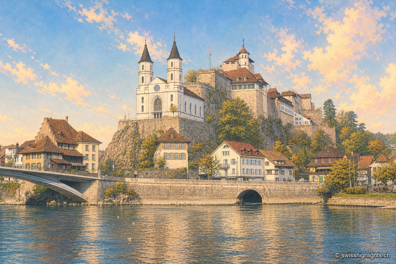
Aarburg seen from the bank of the Aare: the white Reformed church with two black spires stands on its rocky spur, the fortress and its long buildings occupy the ridge above, and the town's houses line the riverbank under a blue winter sky.

For two, a shared experience

Collections

68 member places · AG, AR, BE, BL, BS, FR, GE, GR, JU, LU, NE, NW, OW, SO, SZ, TG, TI, UR, VD, VS, ZG, ZH

Deterministic criterion: at least one suggestion in the corpus is explicitly phrased as an experience shared by two (together, for two, at the end of the day, in the quiet…). The criterion is about editorial phrasing, not a measured quality of the place — it keeps 68 places out of 177, where the mere presence of a suggestion kept all of them.

AarburgHauterive AbbeySaint Urban's AbbeyAlbinenAmstegAndelfingenArlesheimAsconaAumüliBergün/BravuognBerthoud (Burgdorf)BönigenBüren an der AareTrümmelbach FallsCreux du VanDiessenhofenEigerErlachErlenbach im SimmentalErmatingenErnenÉtang de la GruèreFlüeli-RanftGenevaGiornicoAletsch GlacierGlacier ExpressGoetheanumGoldenPass ExpressGorges du TrientGornergratGrande CariçaieGrandvillardGrotte aux FéesGrottes de RéclèreGruyèresHospentalKleine ScheideggLa Chaux-de-FondsLac Bleu d'ArollaLaufenLausanneLöwenburgLucerne, old town and KapellbrückeLuganoJungfrauMerideMönchMorcoteMürrenOeschinenseeKlein MatterhornDufourspitzePorrentruySaint-MauriceSaint-UrsanneSankt ChrischonaSempachSoazzaSolothurnStansTine de ConflensTitlisTrogenTschlinUfenauSchlieren GasworksLorzenweid industrial site
Interactive map — schematic view of Switzerland.

Places in this collection

Aarburg seen from the bank of the Aare: the white Reformed church with two black spires stands on its rocky spur, the fortress and its long buildings occupy the ridge above, and the town's houses line the riverbank under a blue winter sky.

Fortified small town · Aargau

Aarburg

Bern took the town on 20 April 1415 and turned the castle into a fortress. It still holds the spur commanding the valley, above an old town rebuilt after the fire of 4 May 1840.
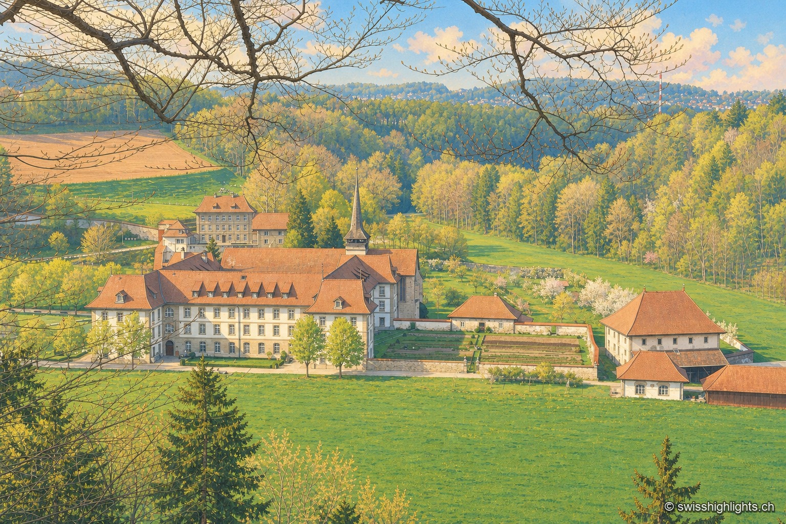
Hauterive Abbey seen from a wooded slope to the south: the long white conventual buildings with brown roofs and the church spire occupy the far end of a spring meadow valley, surrounded by forest, with the abbey's gardens and farm on the right.

Cistercian abbey · Fribourg

Hauterive Abbey

Consecrated on 25 February 1138, suppressed in 1848, repopulated in 1939. Its towerless church, built between 1150 and 1160, has just come through a 2021-2025 restoration and reopened on 4 September 2025.
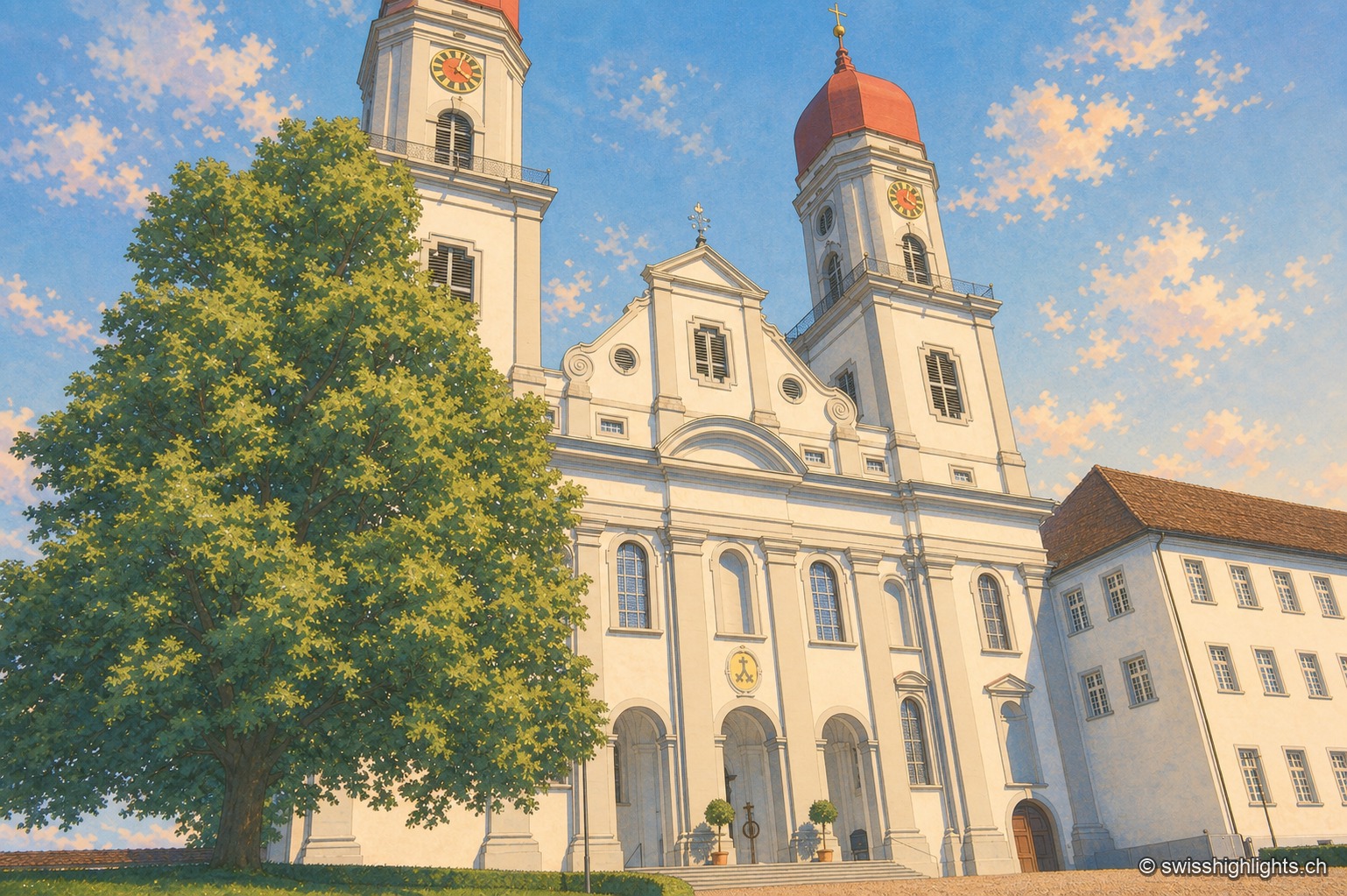
An aerial view of the former abbey of Saint-Urbain: the baroque church with two towers topped by red onion domes stands at the center, surrounded by long white conventual buildings arranged around two courtyards, with the village and fields around it.

Former abbey · Lucerne

Saint Urban's Abbey

Its choir stalls of 1700-1707 were sold as far as Scotland before being bought back in 1911 and reinstalled. Since 1873 the former monastery has housed a cantonal psychiatric institution.
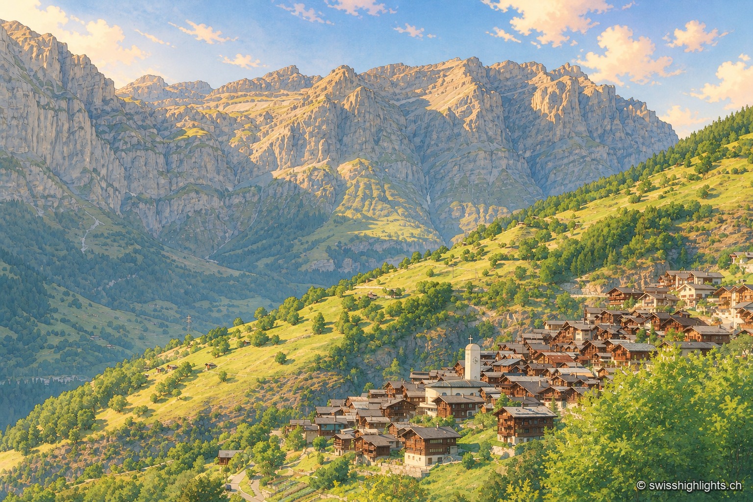
The village of Albinen clustered on its grassy shoulder, its brown wooden houses huddled around the church's white bell tower, with sloping meadows and larches in front of it and, in the background, the long limestone wall that closes off the Dala valley in a bluish morning light.

Mountain village · Valais

Albinen

Until the road of 1956, eight wooden ladders fixed to the cliff were the only way to Leukerbad. They are still there, and the village counts 259 inhabitants.
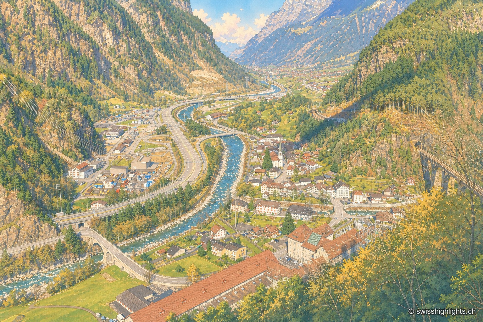
Elevated view of Amsteg from a wooded slope: the village and its bell tower occupy the floor of the Reuss valley, the gravel-banked river crosses it, the motorway and road run along the left bank, and the Gotthard railway viaduct spans the ravine on the right, between steep slopes.

Transit village · Uri

Amsteg

A staging post in the 18th century, ruined by the coming of the railway, revived in the 20th by hydroelectricity: the power station of 1922 was replaced in 1998 by a plant cut inside the mountain.
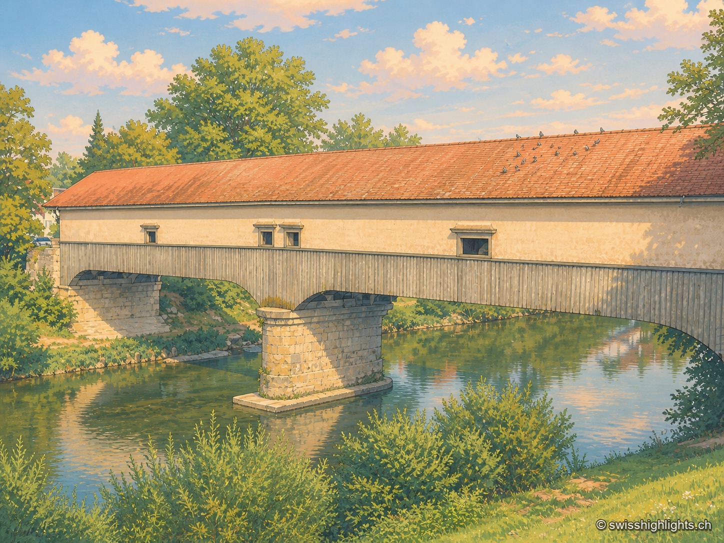
The covered wooden bridge seen from the bank at a three-quarter angle: a long cladding of grey planks and a red tiled roof span the entire frame, carried by a stone pier planted in the middle of the Thur; the calm green water reflects the arch and the vegetation of the banks, and birds are perched in a row along the ridge of the roof.

Weinland town · Zurich

Andelfingen

Recorded in 1248, Andelfingen commanded one of the few crossings of the Thur: a toll, a bridge already widened in 1324, destroyed in 1799 and rebuilt in wood in 1814-1815. The town keeps a castle of 1780-1782 and a chancellery of 1697.
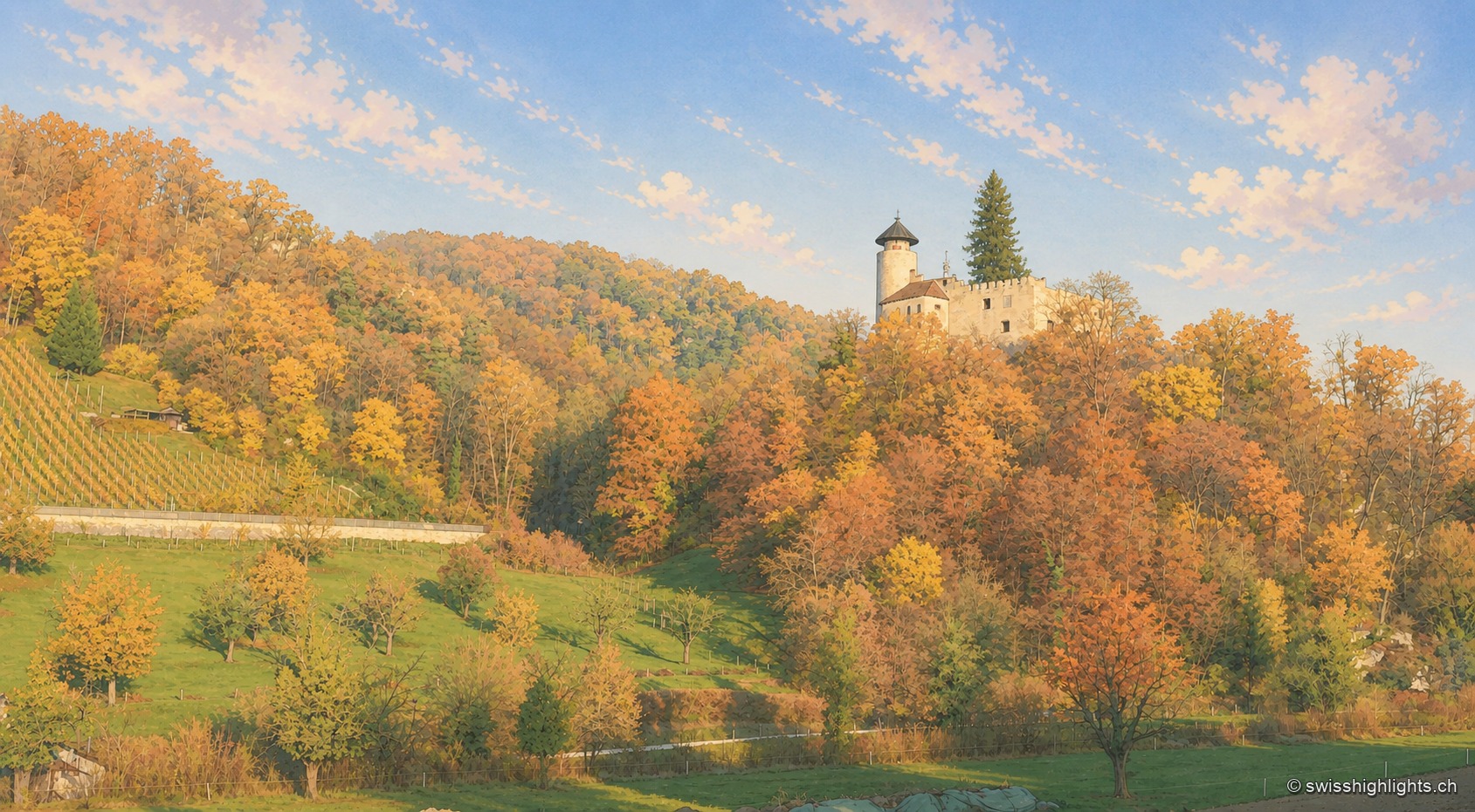
Ermitage pond in Arlesheim in autumn: a white wooden footbridge extends over the water covered with water lilies, in front of a wooded slope with yellow, orange and red foliage.

Village and garden · Basel-Land

Arlesheim

The collegiate church and the canons' houses, built from 1679, close a square laid out in one design. Beyond the village, the Ermitage spreads its grottoes, ponds and paths over some forty hectares.
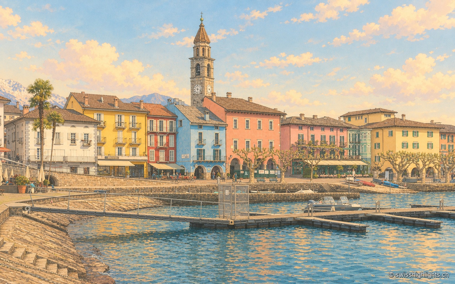
The Ascona lakefront seen from a jetty: a row of yellow, red, blue and pink houses lining the Piazza Motta, the bell tower of the Santi Pietro e Paolo church in the center, a palm tree on the left, and the mountains of Lake Maggiore in the background.

Lakeside town · Ticino

Ascona

A row of painted houses closes the square that opens onto the lake, behind the campanile of Santi Pietro e Paolo. On the hill stand the light-and-air huts of 1901-1902 and the hotel of 1926-1928.
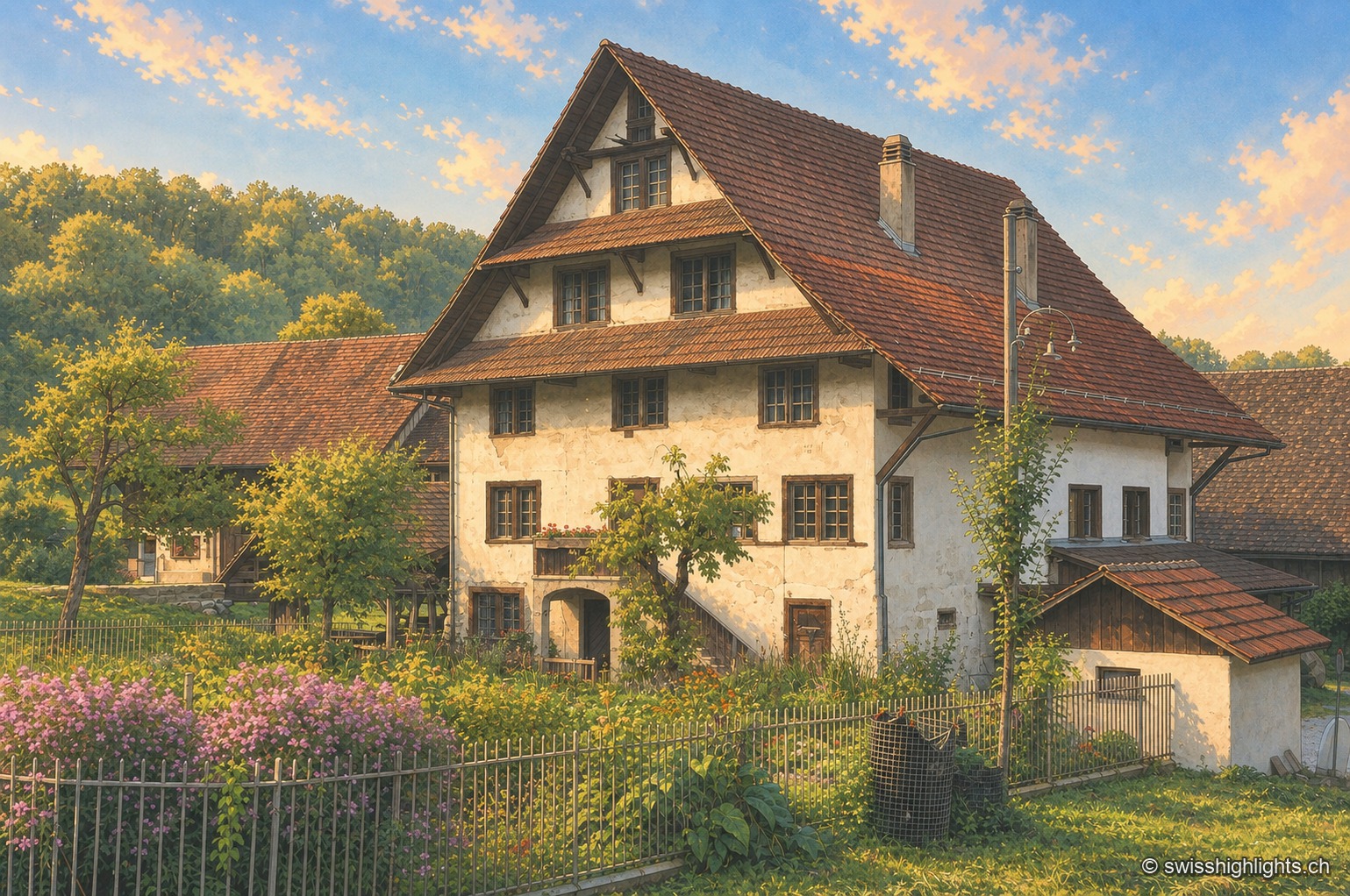
The Aumüli mill and its outbuildings: a tall whitewashed half-timbered façade beneath a wide, steeply pitched brown tile roof with generous overhang, surrounded by a fenced garden where mauve butterfly bushes grow, with the forest on the southern slope of the Albis in the background.

Historic mill · Stallikon, Zurich

Aumüli

Probably built in the 9th century and recorded from 1328, the Aumüli keeps its water right, wheel and sawmill. Listed in 1993 and added to the ISOS register in 2012, it has milled spelt again since 2007.
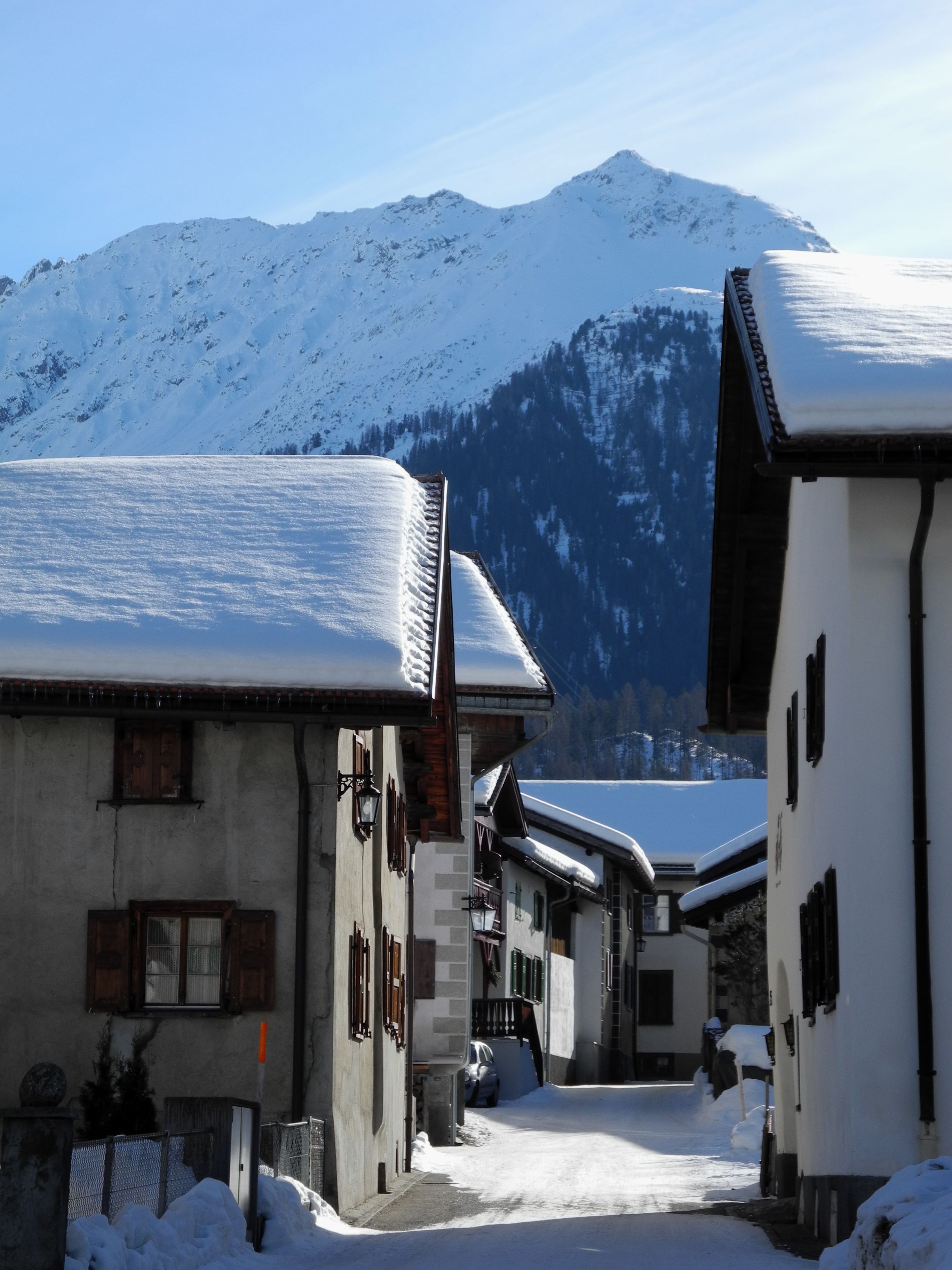
Snow-covered street in Bergün lined with Engadine houses with snow-laden roofs; in the background, a snowy mountainside under a clear sky.

Graubünden · Albula Valley

Bergün/Bravuogn

At 1,367 metres in the Albula Valley, Bergün lines its sgraffito-decorated Engadine houses along one climbing street. Its Romansh name, Bravuogn, has been official since 1943.
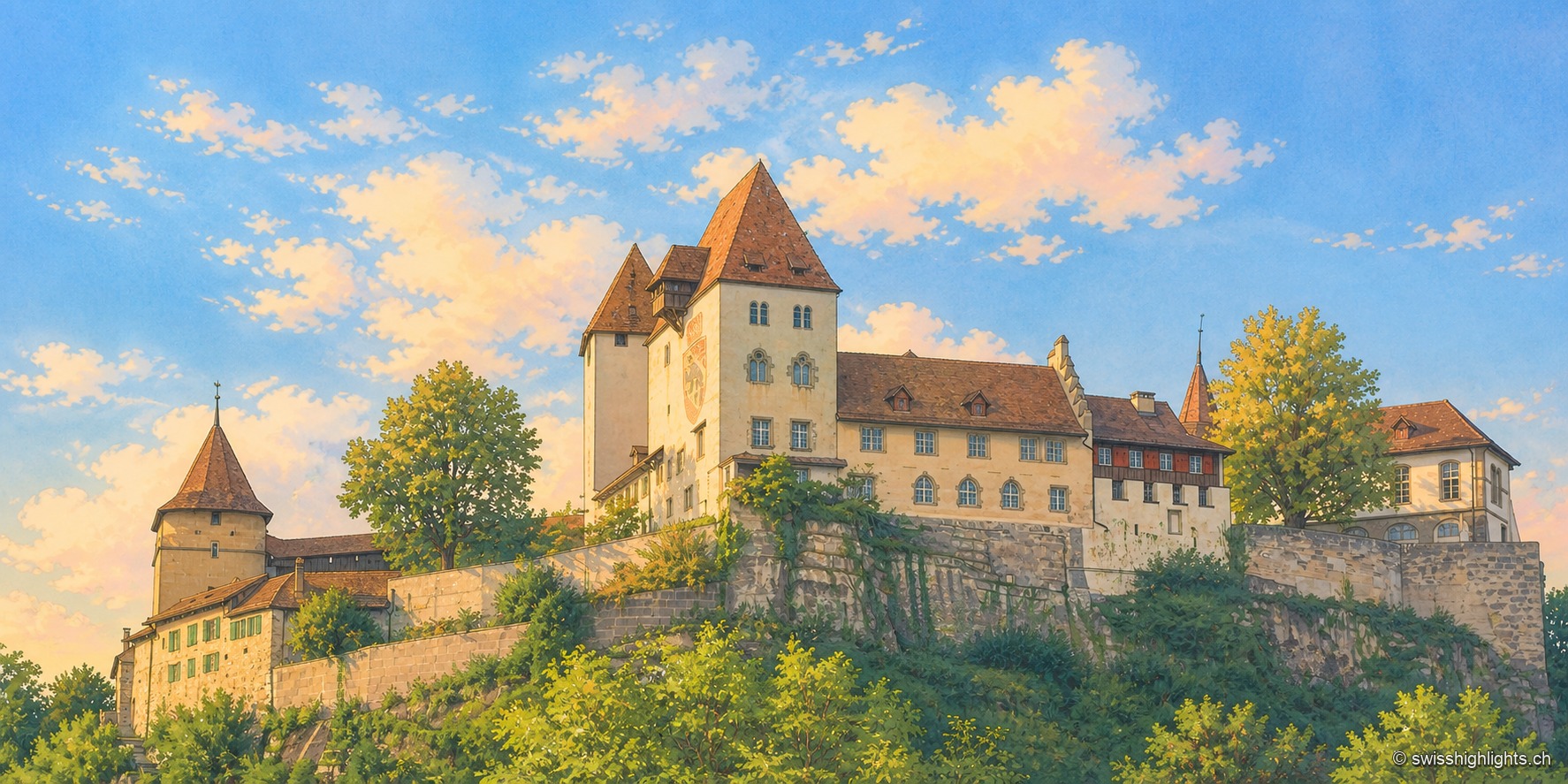
Burgdorf Castle seen from below, at the end of the day: set on a rocky, vegetation-covered outcrop, a square keep with a steep roof, a pale residential wing with blue shutters, and a round tower capped with tiles, under a blue sky streaked with clouds; the raking light illuminates the south-facing façades.

Emmental town · Bern

Berthoud (Burgdorf)

The castle holds the sandstone spur above the town; its name appears as early as 1084. In 1273 the Goldene Handfeste set the town's law in writing, in force for five centuries. In 1899 the line to Thun made it a laboratory of electric traction.
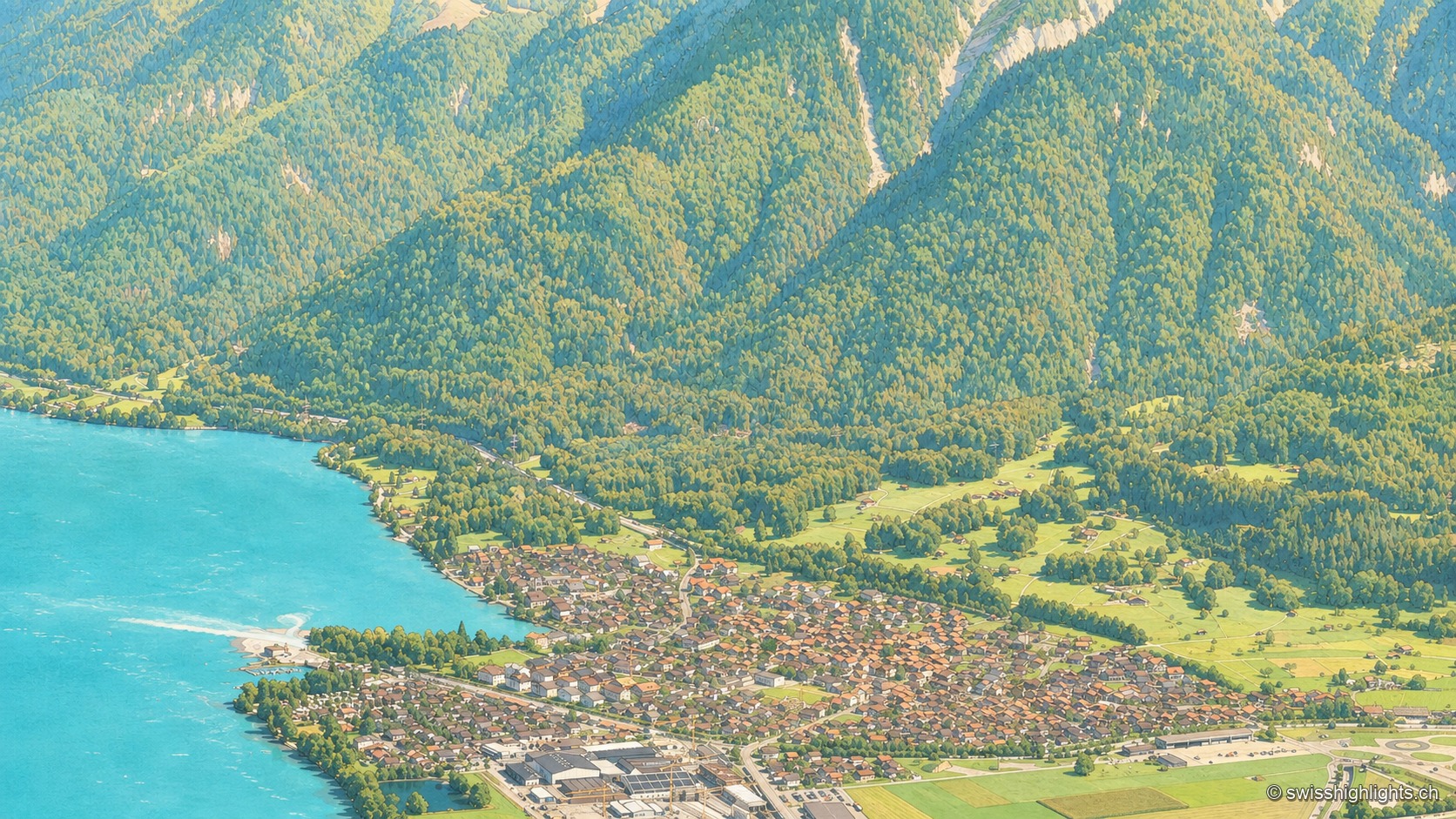
An aerial view from the Harderkulm over the village of Bönigen, nestled at the turquoise mouth of the Lütschine where it flows into Lake Brienz; the village roofs line up between the turquoise water and green meadows, at the foot of steep, fully wooded slopes rising toward the head of the valley.

Bernese village · Lake Brienz

Bönigen

Bönigen, at the mouth of the Lütschine into Lake Brienz, was an imperial fief of the barons von Eschenbach ceded to Interlaken convent in 1261; the village refused the Protestant Reformation in 1528 and today has 2,786 inhabitants.
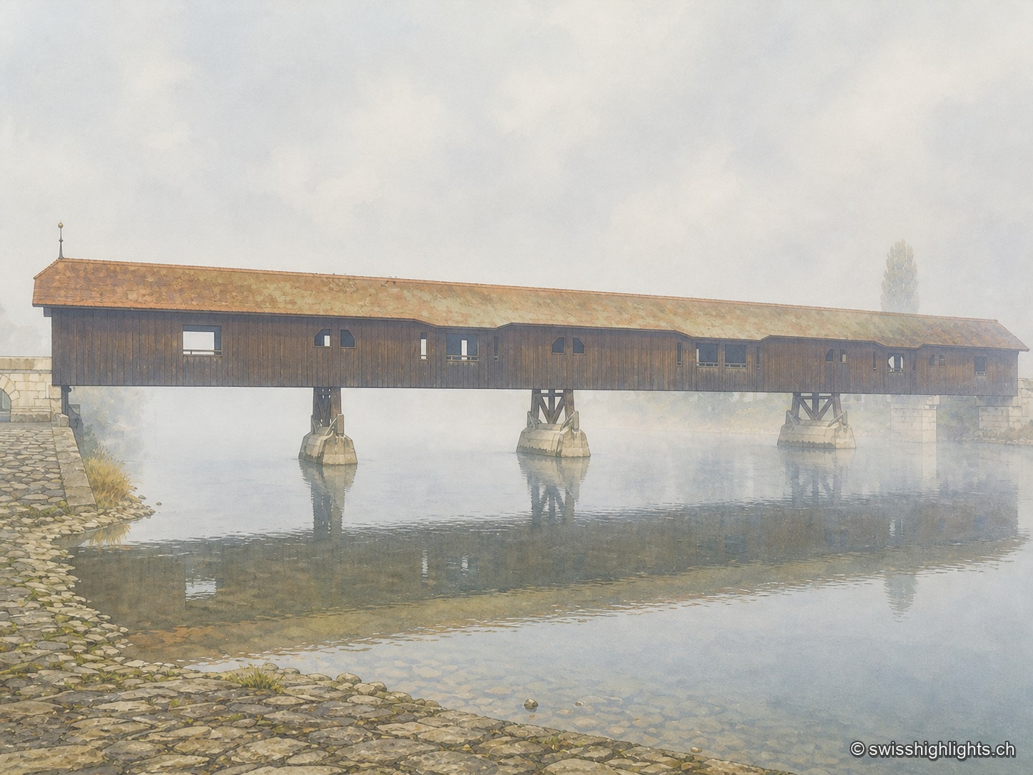
The covered wooden bridge of Büren an der Aare seen from the side on a foggy morning: a long dark wooden deck under an ochre tiled roof, carried on masonry piers in the middle of the Aare, above which mist rises over the calm water; in the foreground, the paved riverbank.

Medieval small town · Seeland

Büren an der Aare

A timber crossing has linked the two banks since the 13th century. Destroyed eight times by floods, ice or fire, it is now in its ninth version, opened in 1991 after the arson of 1989.
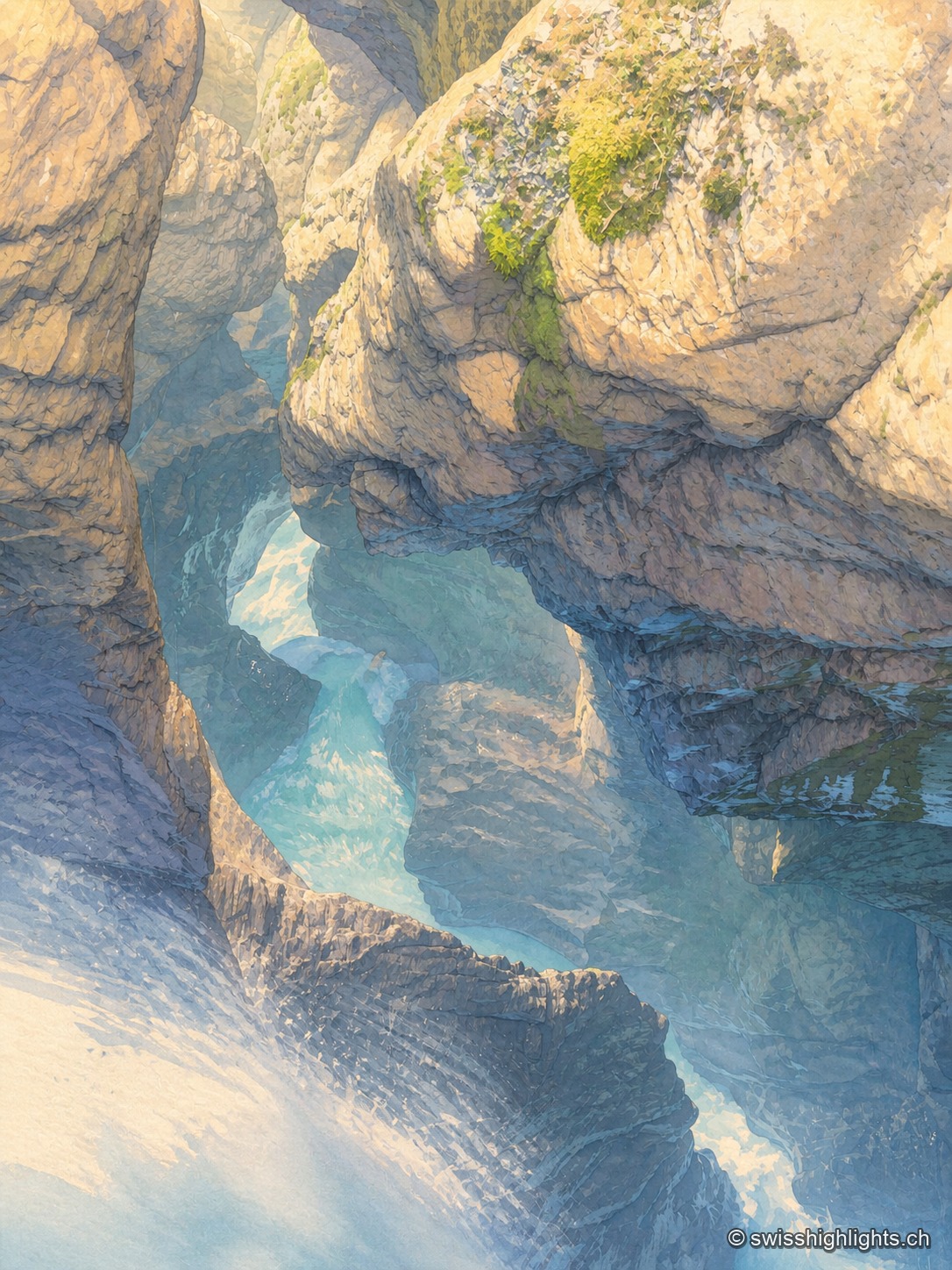
At the bottom of a narrow gorge, the milky turquoise water of the Trümmelbach glides in long exposure between walls of polished limestone; mist rises from the current, and a few tufts of green moss catch the light on the overhanging rock.

Underground falls · Bernese Oberland

Trümmelbach Falls

The Trümmelbach alone drains the glacier faces of the Eiger, the Mönch and the Jungfrau: up to 20,000 litres a second in a gorge so narrow that daylight no longer reaches the upper falls.
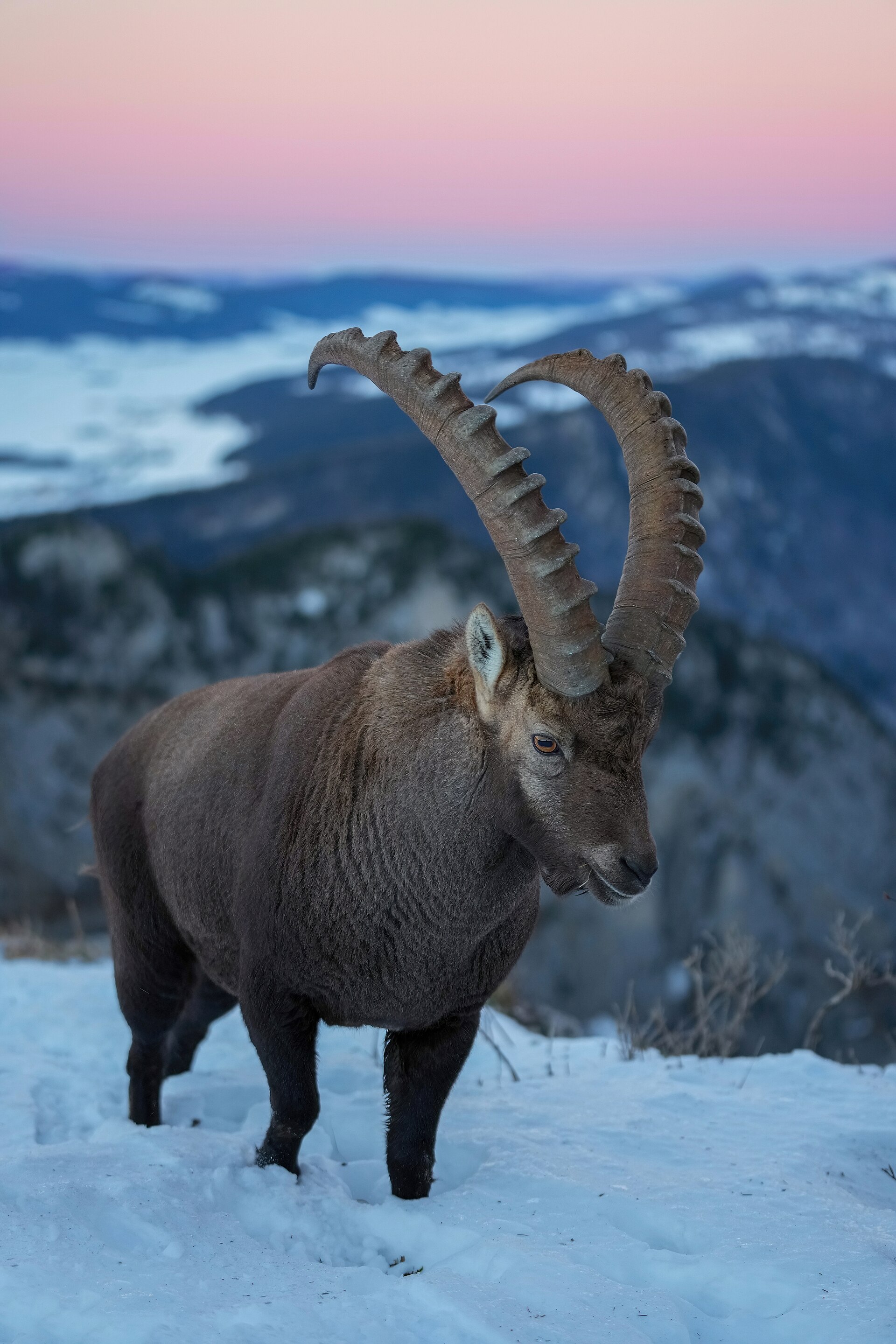
A male Alpine ibex, with long ringed horns, stands on a snowy slope at the Creux du Van; behind it rise wooded Jura ridges under a pink end-of-day sky.

Rock cirque · Neuchâtel

Creux du Van

A limestone wall closes an arc 1,000 to 1,400 metres across. Ibex, chamois and lynx live in the 15.5 km² reserve around the cirque, crowned by Le Soliat at 1,464 metres.
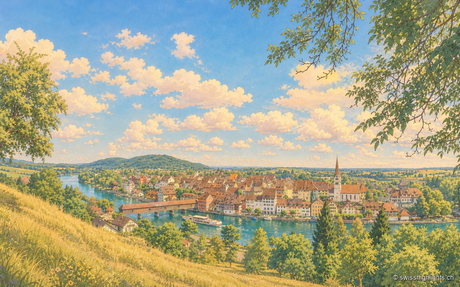
Elevated view of Diessenhofen from a height on the opposite bank: the Rhine looping through, the covered wooden bridge on the left, a passenger boat before the quay, the tightly packed roofs of the town and the church bell tower at the center, under a summer sky with cumulus clouds.

Rhine town · Thurgau

Diessenhofen

Raised to town status in 1178 by the counts of Kyburg, Diessenhofen has kept its medieval street plan, its Seal Tower with a zodiac dial, and its covered wooden bridge across the Rhine into Germany.
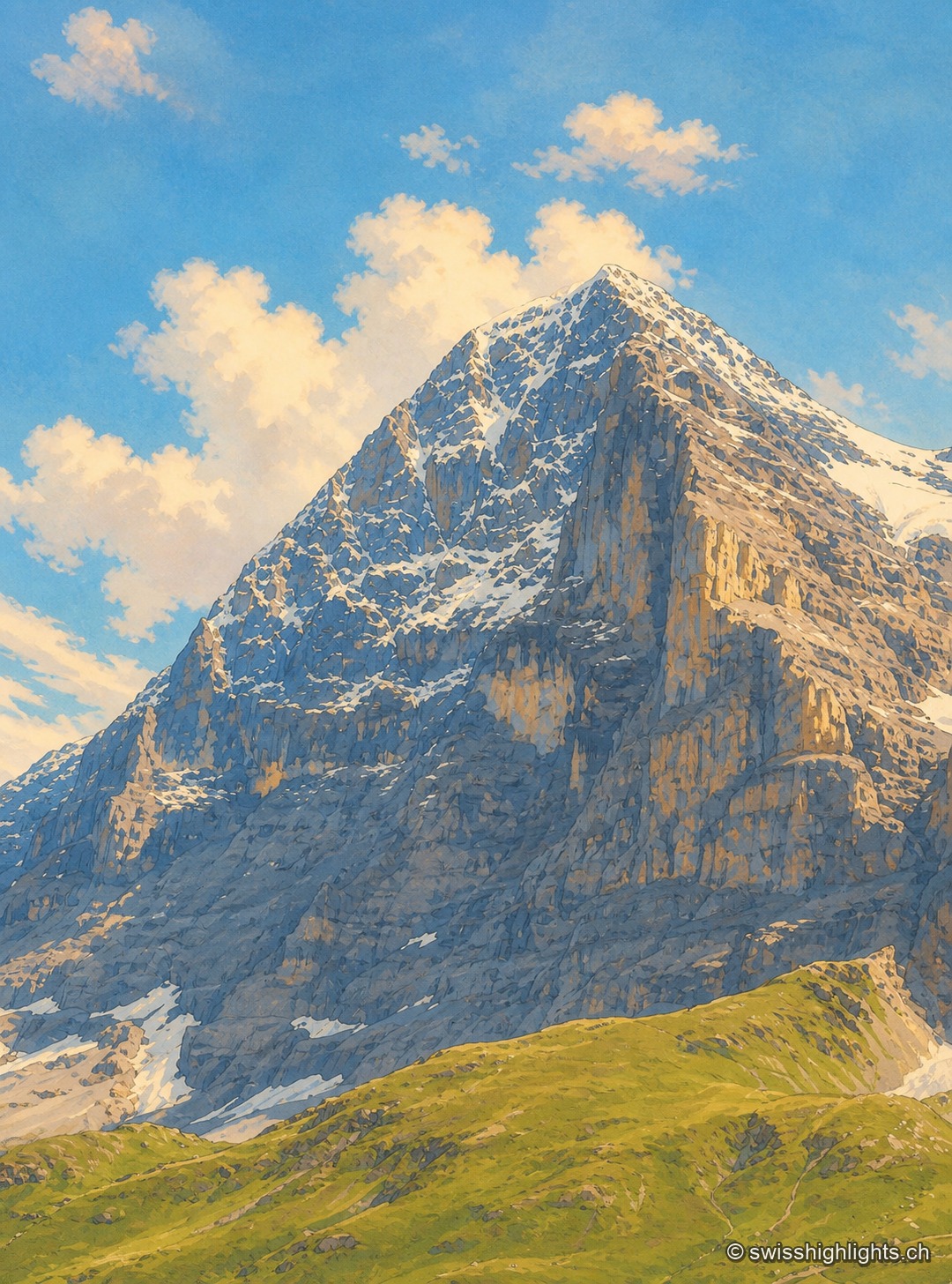
The north face of the Eiger seen head-on in summer: a wall of dark limestone streaked with tilted strata, topped by a snow-covered summit pyramid under wispy clouds, with grassy slopes and snow patches at the foot of the face.

Summit · Bernese Alps

Eiger

The Eiger carries its summit to 3,967 metres above Grindelwald. Its north face, about 1,650 metres high, was not climbed until July 1938; since 1912 a railway has run through the mountain itself.
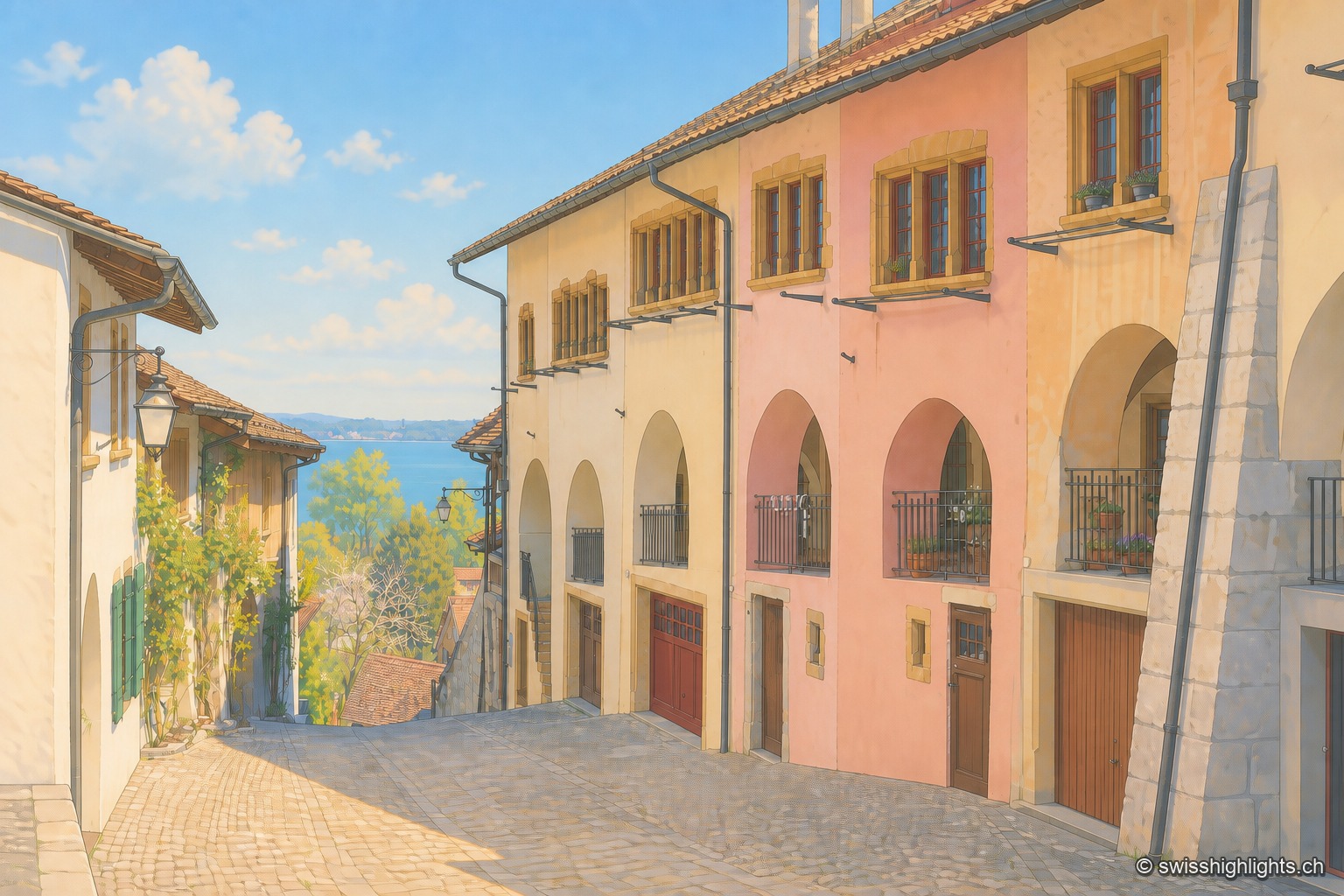
Cobbled lane in Erlach's old town running down toward Lake Biel: on the right, a row of houses with pink, cream and ochre façades pierced by round arches and wrought-iron balconies; in the distance, the lake's surface glitters under a clear blue sky.

Medieval town · Lake Biel

Erlach

The castle that has overlooked Erlach since the year 1100 gave its name to the patrician von Erlach family; the town, a member of Switzerland's Most Beautiful Villages since 2017, looks out from Jolimont hill toward St Peter's Island.
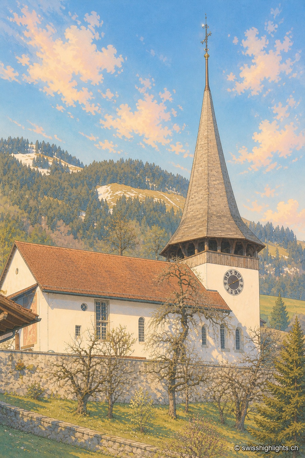
The Reformed church of Erlenbach im Simmental, with its white facade and pointed spire, at the foot of the Bernese Prealps.

Gothic frescoes, birthplace of the Amish

Erlenbach im Simmental

Whitewashed over during the Reformation (1527/28), the church's Gothic frescoes were thereby preserved until their restoration in 1931-32. An organ built in 1812 by Johannes Stölli completes this Bernese heritage.
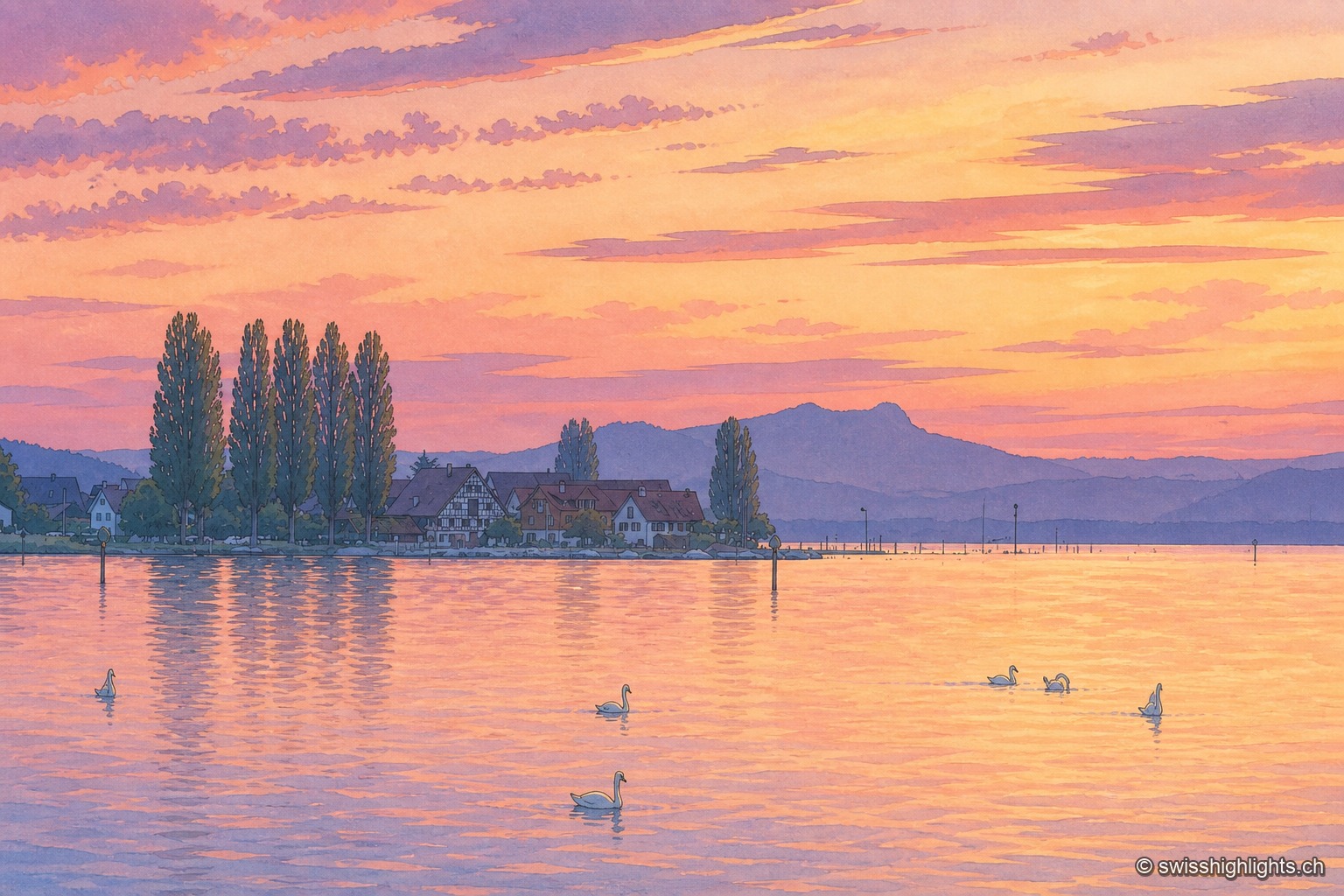
Orange sunset over the Untersee: backlit, the built-up shoreline of Ermatingen and its poplars stand out in silhouette above the water, where about ten swans are swimming; on the horizon, the hills of the Hegau.

Lakeside village · Thurgau

Ermatingen

First named in 724 in the founding charter of Reichenau Abbey, Ermatingen lines up its half-timbered houses along the water. Its carnival, the Groppenfasnacht, falls on Laetare Sunday, three weeks before Easter.
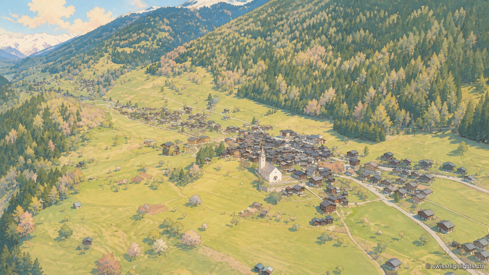
An aerial view of the village of Ernen in spring: the brown houses clustered around the white church occupy a terrace of short grass, bordered above by a larch forest and open on the left to the Rhône valley and snow-capped peaks.

Goms village · Valais

Ernen

Around a square lined with houses dated from 1511 to 1762 stand a church whose choir was finished in 1518 and the Tellenhaus of 1576, which carries a William Tell scene painted in 1578.
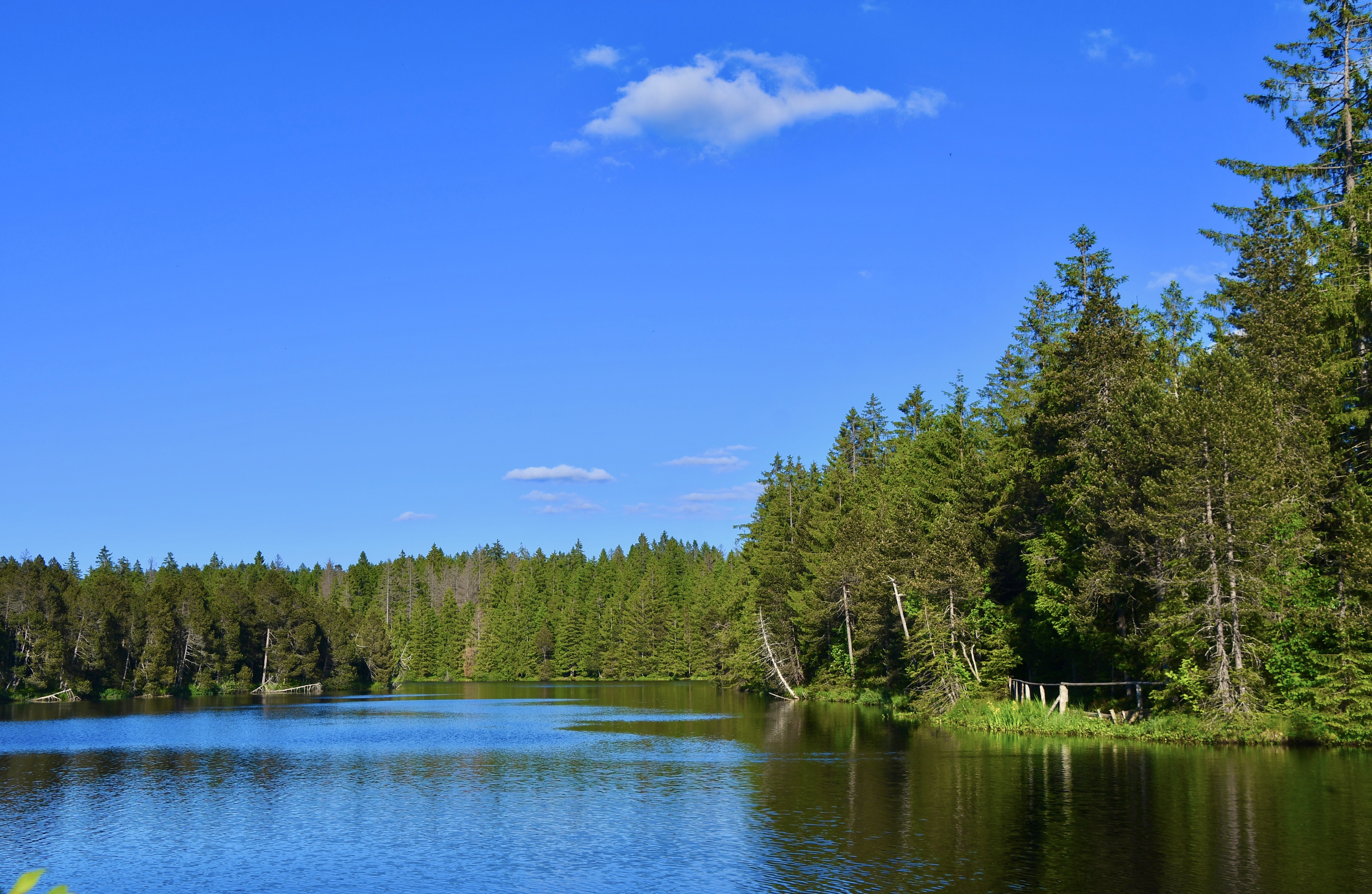
The Étang de la Gruère on a calm day: the spruce forest and a sky streaked with clouds are mirrored perfectly in the water, with rushes and a clump of reeds in the foreground on the right.

Protected raised bog · Jura

Étang de la Gruère

At 998 metres, in the municipality of Saignelégier, a body of water five hundred metres long bordered by a 56-hectare peat bog, where peat has built up to nine metres thick over twelve thousand years.
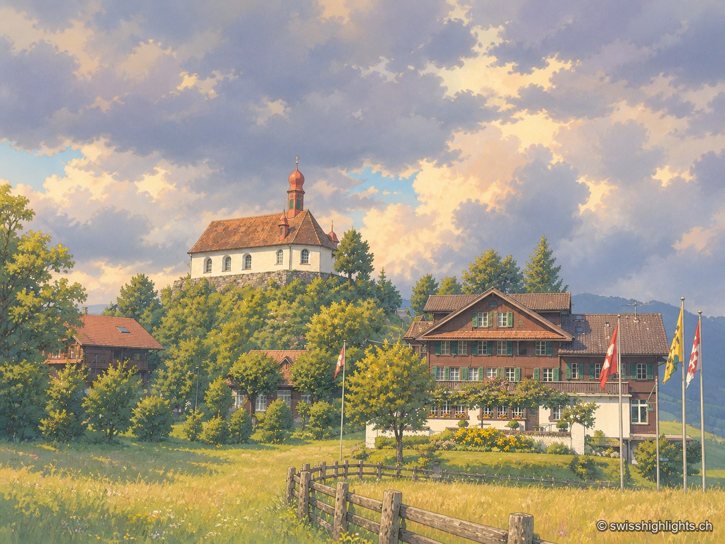
Under a grey sky with low clouds, the Saint Charles Borromeo chapel crowns a wooded knoll with its red roof and onion-domed spire; below, the brown-timbered Paxmontana inn flies flags, surrounded by parked cars and sloping green meadows.

Pilgrimage village · Obwalden

Flüeli-Ranft

Niklaus von Flüe (1417-1487) withdraws to the Ranft in 1467. The upper chapel is consecrated in 1469, the lower chapel built in 1501. Canonised on 15 May 1947 under Pius XII, he gave his name to the village, called only Flüeli until 1966.
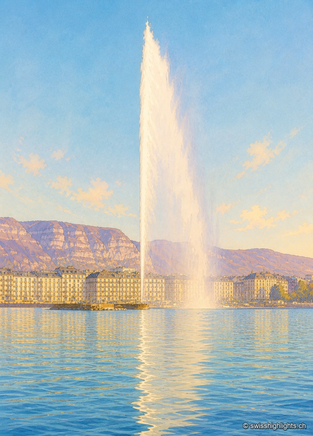
The Geneva Water Fountain seen from the shore in winter: the white column of water rises very high into a cloudless blue sky and curves slightly to the right. In the background, the row of light-colored buildings along the quay is lit by low sunlight; behind them rises the limestone cliff of the Salève. The foreground is filled with the rippled water of the lake, reflecting the column of the fountain.

City · Canton of Geneva

Geneva

The commune covers 15.93 km² and counted 203,856 inhabitants; the cross-border conurbation around it holds 1,053,436. Since 1891 the Jet d'Eau has thrown its column 140 metres above the bay.
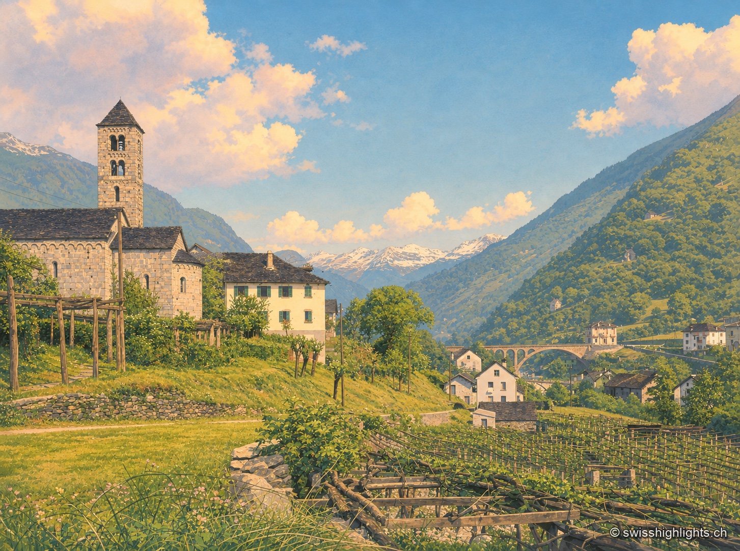
Old black-and-white photograph, taken from a vine-planted slope. On the left, a stone church with a rounded apse and square bell tower, pierced by narrow twin windows, overlooks vine pergolas and a few dark-roofed houses, including a large light-colored building with shutters. At the center, the valley opens toward a snow-capped range, under a sky where large cumulus clouds are building. On the right, a stone bridge with a large arch spans the riverbed in front of a wooded slope and a few houses. In the foreground, low rows of vines and wooden stakes.

Ticino village · Leventina

Giornico

The river holds an island here, reached by two bridges of the Middle Ages. Apart from the village, the La Congiunta museum, built by Peter Märkli, contains nothing but reliefs and sculptures by Hans Josephsohn, made between 1950 and 1991.
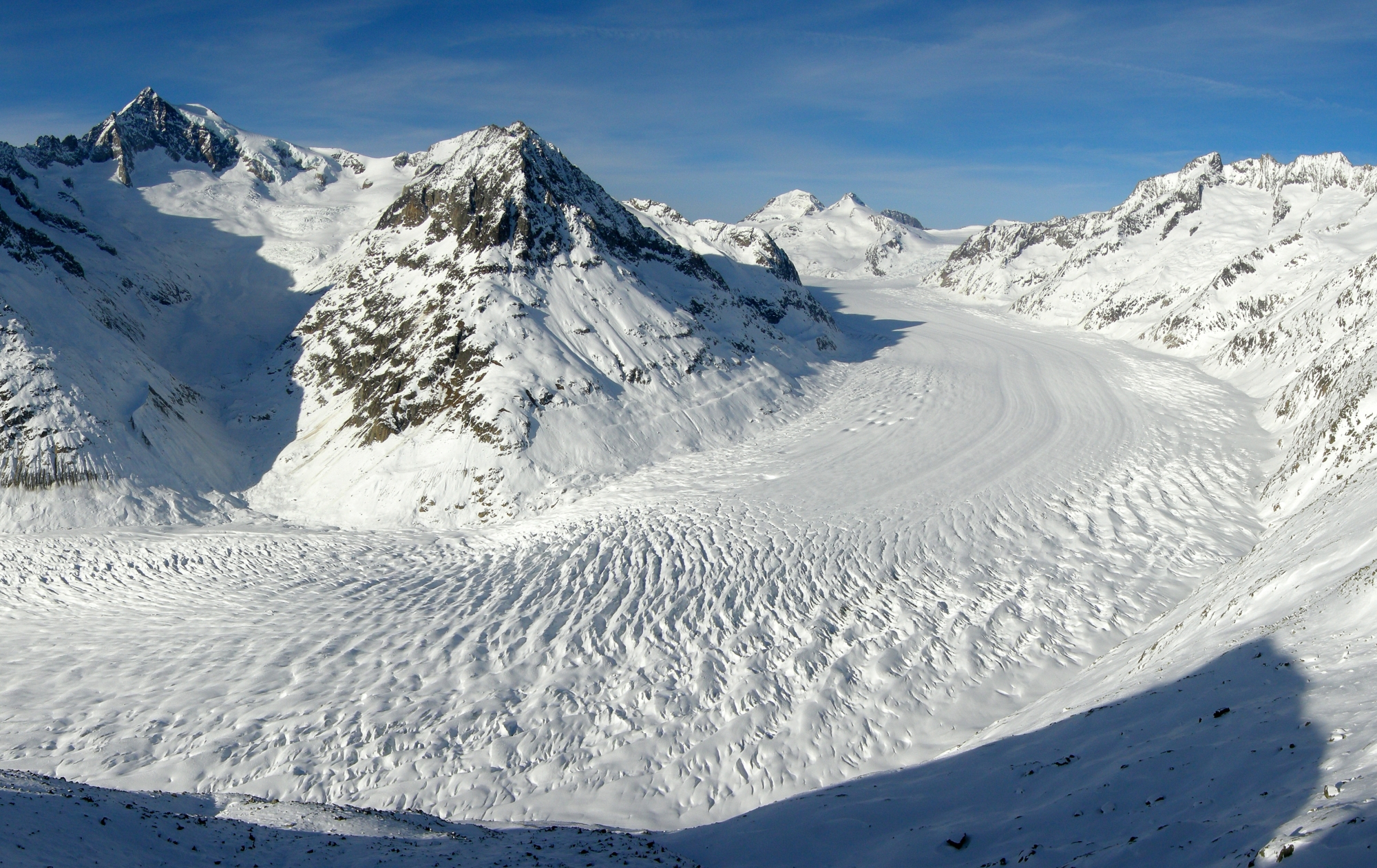
The Aletsch Glacier seen from the Eggishorn: the river of ice, streaked with long parallel dark bands, sweeps in a wide curve between snow-covered slopes; in the distance, the peaks of the Bernese Alps stand out under a blue sky.

Glacier · Valais

Aletsch Glacier

Three rivers of ice meet at Konkordiaplatz to form the largest glacier in the Alps. It flows 180 to 200 metres a year and loses up to 50 metres of length annually.
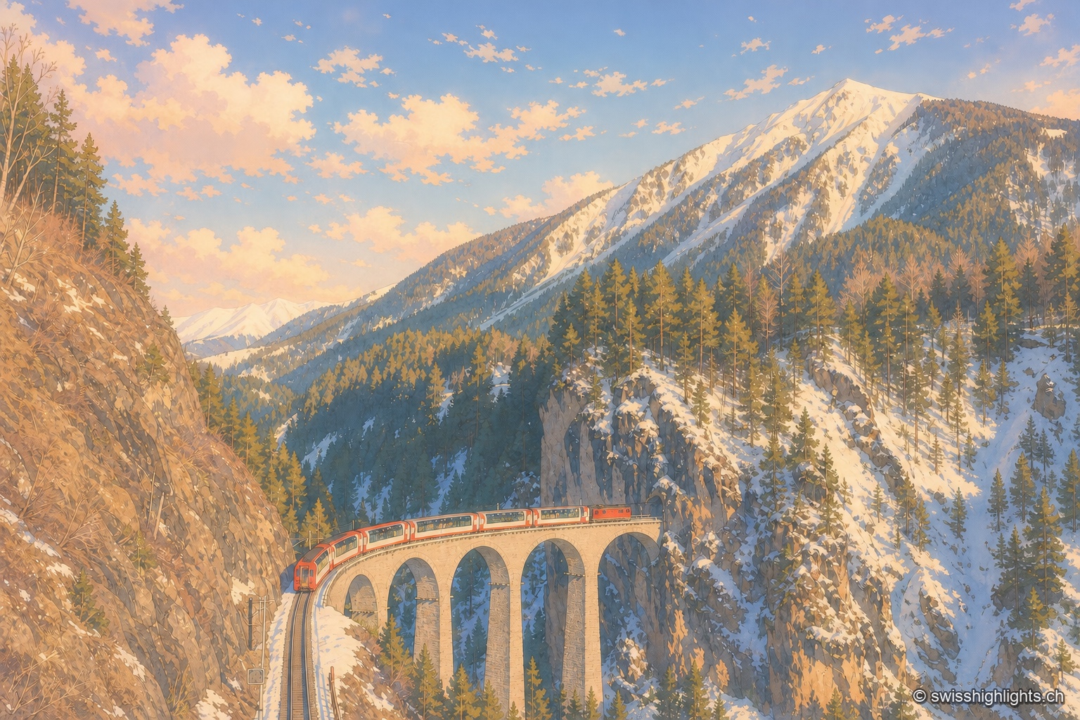
A red and white Glacier Express train, its panoramic cars broadly glazed, curves along the stone arches of the Landwasser Viaduct and is about to head straight into the tunnel cut directly into the limestone wall; opposite, a slope of dark conifers descends to the bottom of the ravine, and the track the train has just left can be made out below to the left.

Railway line · Valais–Graubünden

Glacier Express

The train crosses 291 bridges and 91 tunnels over 291 kilometres of metre-gauge track, climbs to the Oberalp Pass at 2,033 metres and drops again to Chur, at 585 metres, its lowest point.
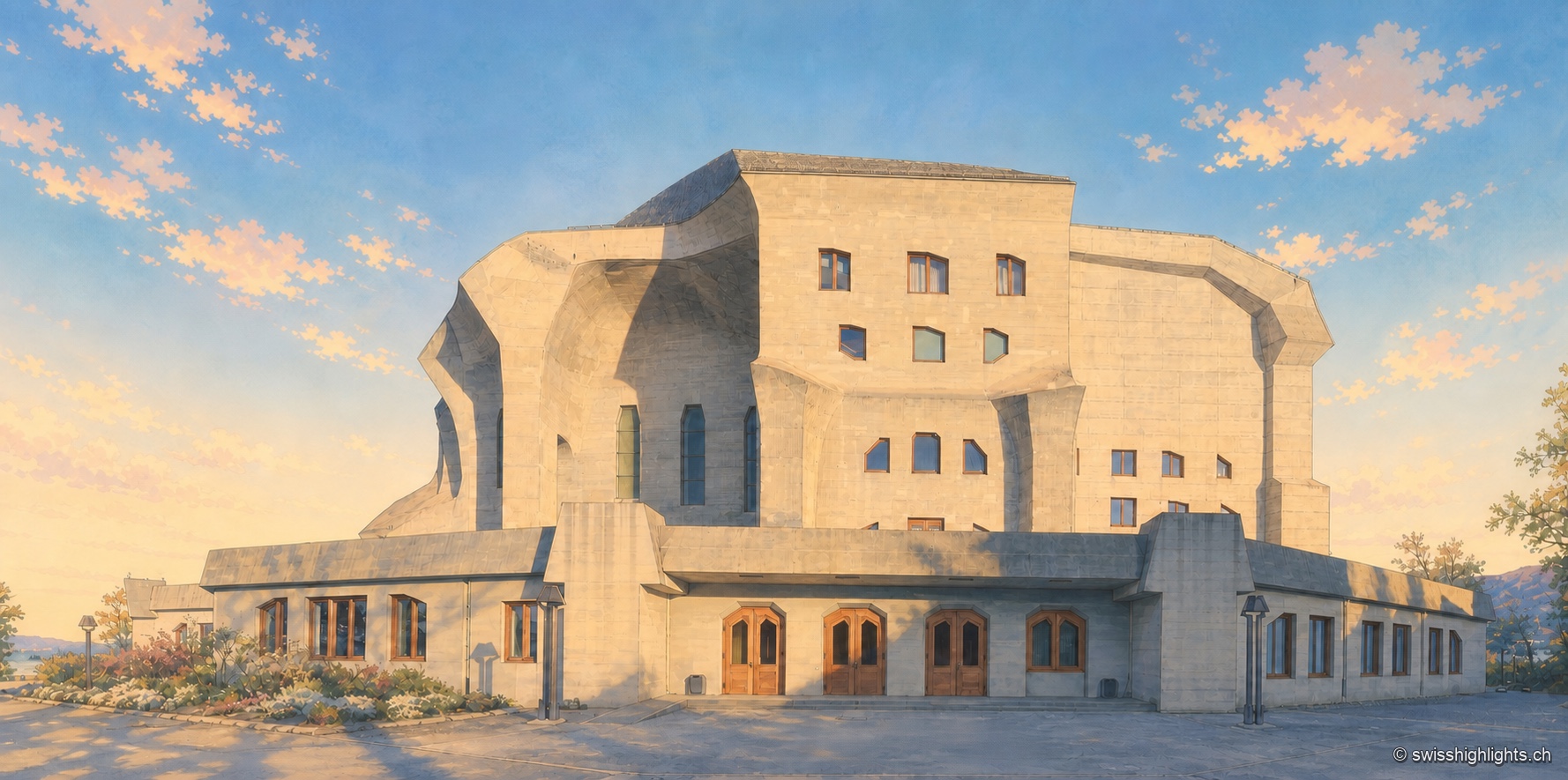
Overview of the Goetheanum at the end of the day: the monumental concrete facade, with its overlapping angular and curved volumes, is pierced by tall windows and dark wooden doors aligned on the ground floor; a few shrubs line the entrance, under a blue sky streaked with pink and golden clouds.

Monument · Dornach, Solothurn

Goetheanum

The first building, in wood, burned down on New Year's night 1923. The second, raised from 1925 to 1928, was the first monumental building in reinforced concrete; its great hall was not inaugurated until 1998.
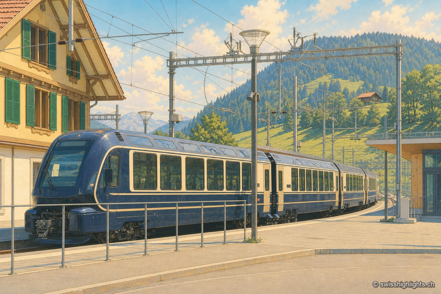
At the platform in Zweisimmen station, the GoldenPass Express train shows off its rounded midnight-blue nose and cream body outlined with a golden stripe, with wide windows running its full length. On the left, a wooden chalet with green shutters bears the station's name; behind the train, mown meadows and woods rise toward the ridges of the Simmental under a summer sky with cumulus clouds.

Railway line · Vaud–Bern

GoldenPass Express

Between Lake Geneva and the Bernese Oberland the train moves from 1,000-millimetre track to 1,435: the wheels spread apart and the body adjusts to platforms that rise from 300 to 560 millimetres.
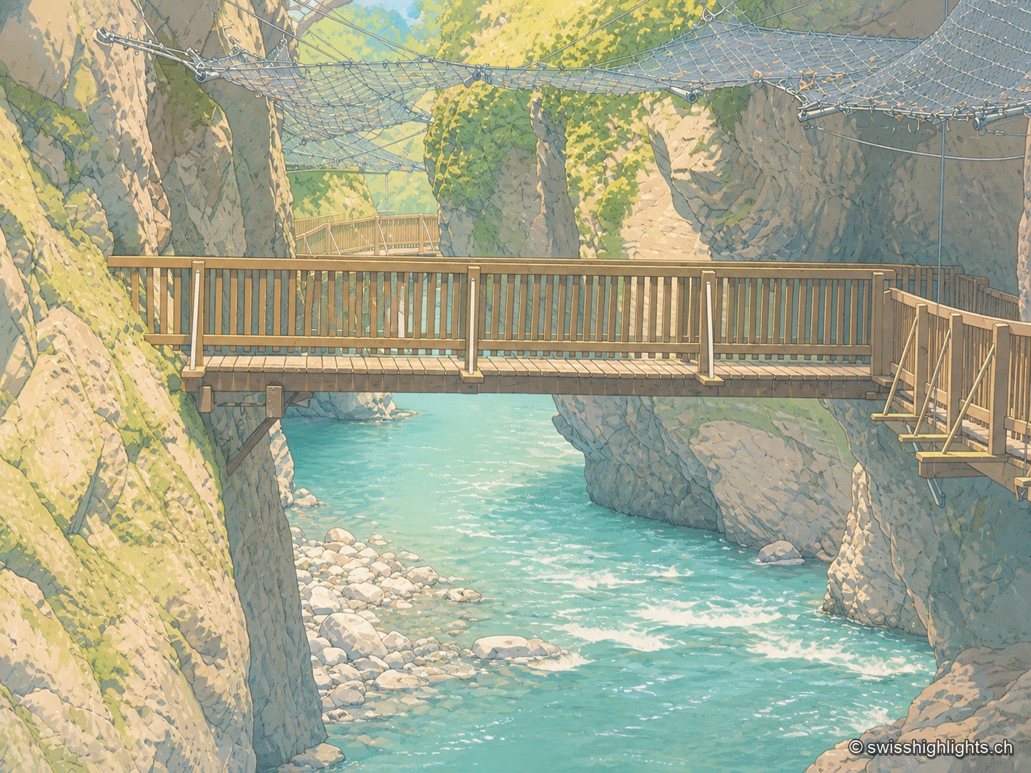
Wooden footbridge with a railing crossing the Trient Gorges above bright turquoise water, between two mossy rock walls; in the background, another footbridge and a safety net stretched above the gorge.

Alpine gorge · Valais

Gorges du Trient

Between the communes of Salvan, Vernayaz and Martigny, the Trient has carved a 2 km gorge through rock combining moraine deposits, amphibolite, limestone and schist; two bridges mark the trail that follows it to the Pissevache waterfall.
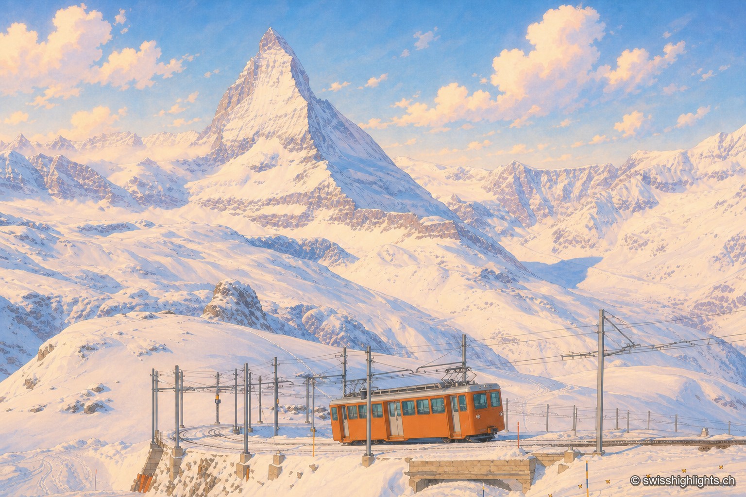
An orange railcar of the Gornergrat railway crosses a small snow-covered stone bridge, between the overhead lines and their metal masts; behind it, the white slopes of the Gornergrat rise toward the Matterhorn, a dark, snow-covered pyramid dominating the range, under a late-afternoon sky streaked with pink clouds.

Summit ridge · Valais

Gornergrat

From this ridge at 3,133 metres, more than twenty Alpine summits above 4,000 metres can be taken in at once. A rack railway has climbed here since 1898, and two hotel towers house observatories.
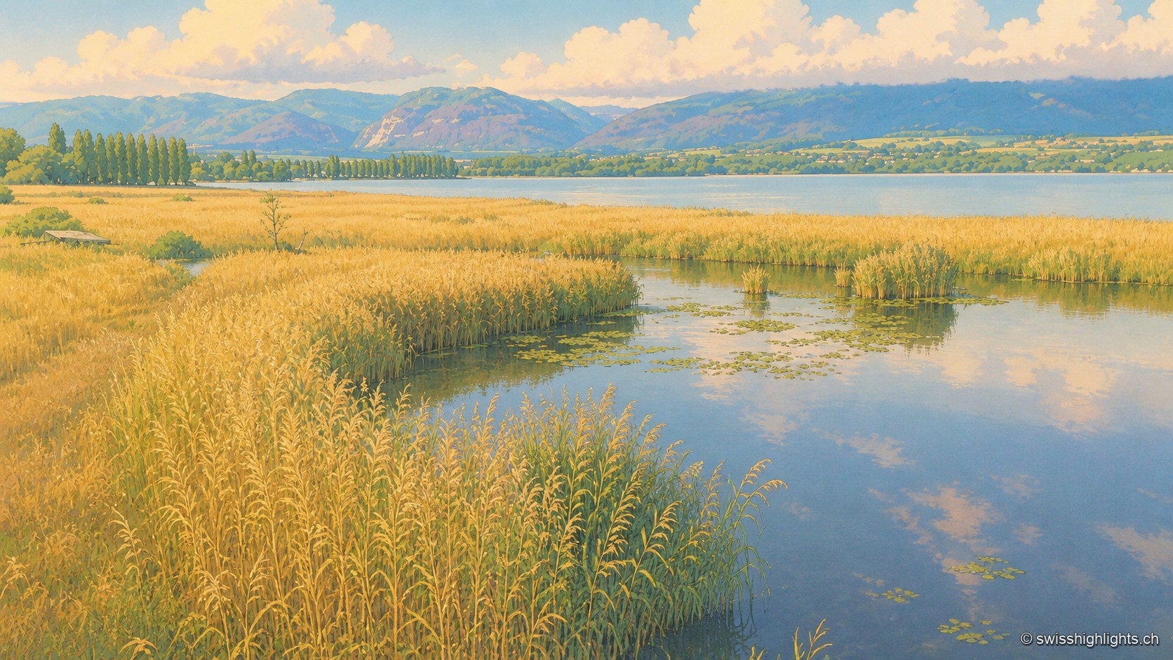
A vast golden reed bed of the Grande Cariçaie crossed by a calm water channel dotted with water lilies, which joins Lake Neuchâtel lined with a row of poplars; on the horizon, the hills of the Jura rise in tiers under a summer sky heavy with cumulus clouds.

Lakeshore marsh · Lake Neuchâtel

Grande Cariçaie

Eight intercantonal nature reserves cover about 3,000 hectares of reedbed, marsh and flooded forest. The landscape only exists because the Jura water correction lowered the lake by 2.7 metres between 1868 and 1891.
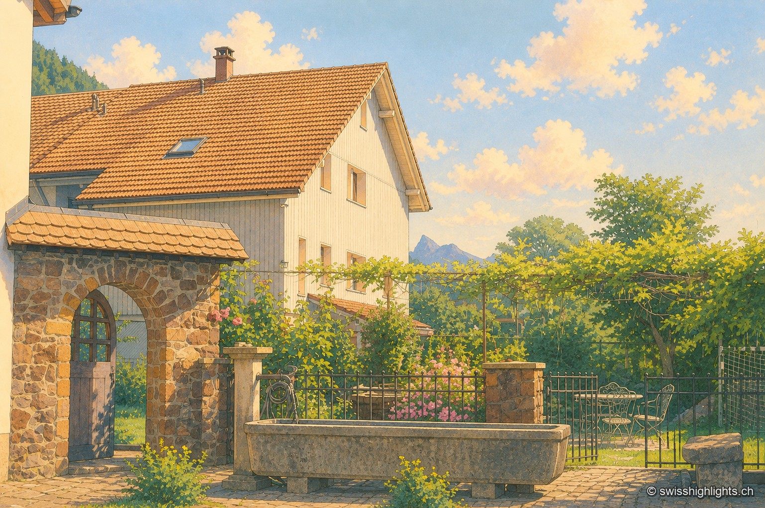
Farmyard in Grandvillard: a round-arched stone porch under a tiled lean-to roof, a climbing rose on a wooden pergola, and an old stone trough in front of a wrought-iron gate; in the background, the white, tile-roofed facade of the house and a peak of the Fribourg Prealps stand out under a summer sky.

Listed village · Gruyère

Grandvillard

Freed from mainmorte in 1388, the commune obtained its charter of liberties in 1439. The present church was consecrated in 1603, the bridge over the Sarine built in 1641. Since 2019, among the Most Beautiful Villages of Switzerland.
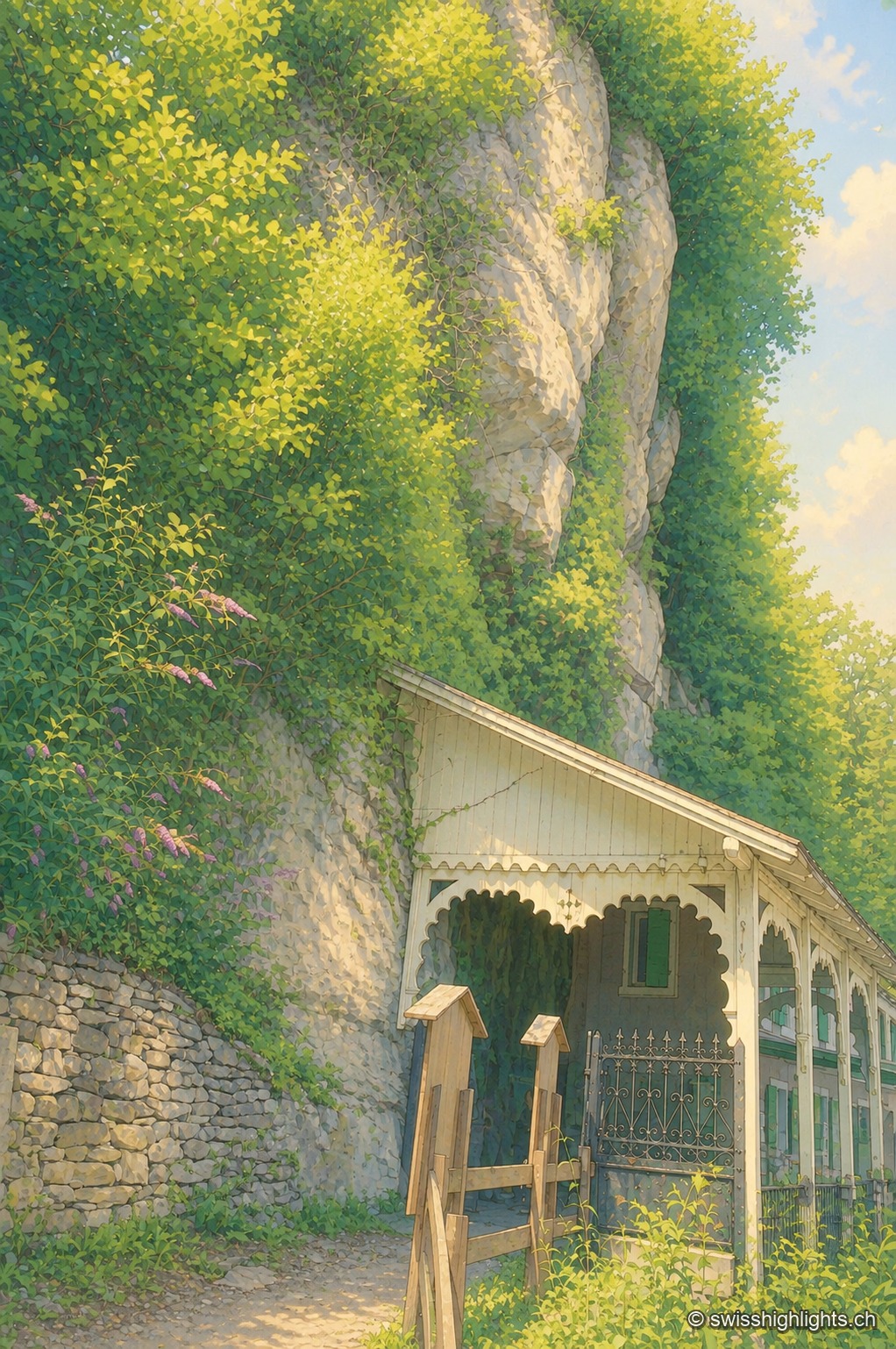
The entrance to the Grotte aux Fées, at the foot of a rock face overgrown with ivy and bushes: a small wooden shelter with a sloping roof protects the entrance, at the end of a path bordered by a white railing, under a clear summer sky.

Show cave · Valais

Grotte aux Fées

Opened to the public on 15 August 1864, the developed gallery follows the rock for 504 metres and ends beneath a 77-metre fall. Beyond it lies a network of 3,630 metres that the army extended between two Valais forts.
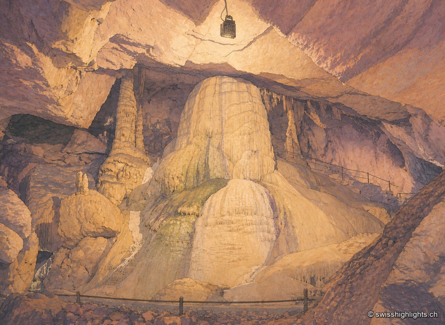
In a vast underground chamber, an imposing calcite formation in ochre and mauve tones rises from the floor to touch the vault, under artificial lighting that alternates warm tones and bluish reflections; a safety railing lines the passage in the foreground.

Show cave · Jura

Grottes de Réclère

A pit that farmers called the 'Trou du Fahy' and used as a dump, revealed by the regional press in 1889: the Grottes de Réclère formed by collapse in a Jurassic limestone about 155 million years old.
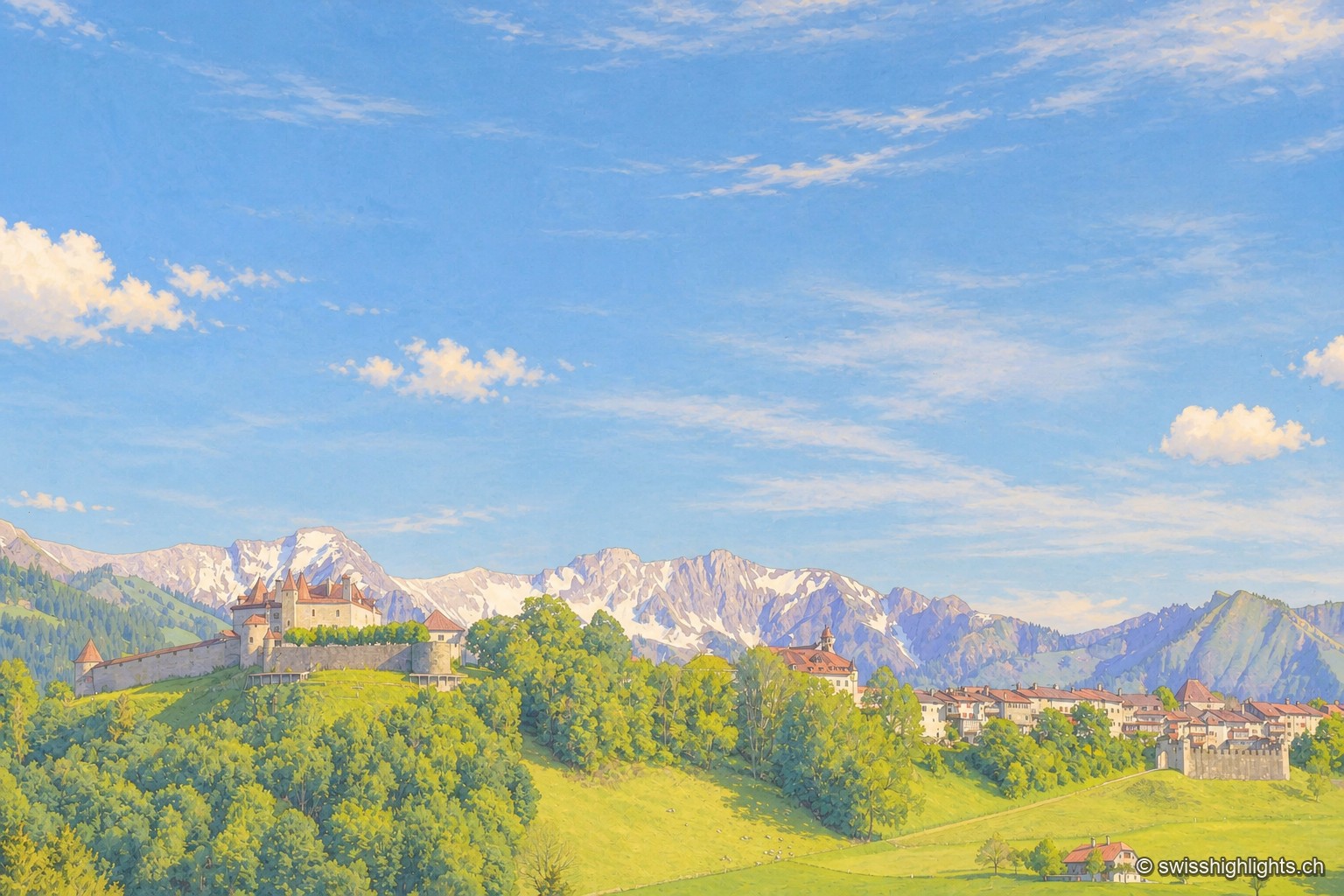
View of Gruyères and its castle perched on a green hill surrounded by ramparts, with the snow-capped peaks of the Fribourg Prealps standing out on the horizon under a blue sky streaked with clouds.

Medieval small town · Fribourg

Gruyères

2,339 inhabitants, a castle shaped by eight centuries of building, a museum of Tibetan art and another devoted to H. R. Giger: Gruyères sits on a rocky spur, its territory ranging between 693 and 2,002 metres.
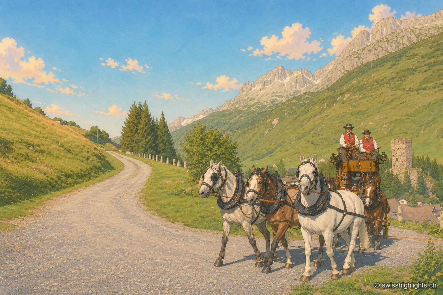
A team of five horses, three dappled grey and two bay, pulls a yellow-and-black stagecoach along a gravel road descending into the Urseren valley; two postilions in red waistcoats and black hats hold the reins. On the right, the ruined square tower of Hospental stands on a grassy knoll above the village rooftops; in the background, rocky ridges and snowfields close off the valley under a cloudless blue sky.

Gotthard village · Uri

Hospental

182 inhabitants, a 13th-century tower emptied of its floors, timber houses rebuilt after the fire of 1669: Hospental stands where two torrents meet to become the Reuss.
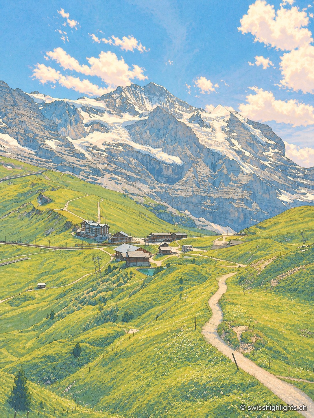
Portrait-format view from a trail on the Kleine Scheidegg: a path descends between green slopes toward mountain buildings and the railway line, facing the imposing north face of the Eiger dominating the horizon.

Railway pass · Bernese Oberland

Kleine Scheidegg

The pass divides only the two arms of the Lütschine, hence its name, the minor watershed. From it the Eiger at 3,967 metres, the Mönch at 4,110 and the Jungfrau at 4,158 appear at once. The first hotel was built here in 1840.
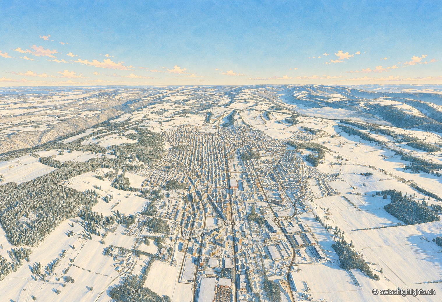
Winter aerial view of La Chaux-de-Fonds: under a deep blue sky, the town stretches its long parallel streets along the bottom of a snow-covered valley, the white roofs forming a regular grid between the pastures and fir forests of the Jura, the horizon closed off in the distance by a sea of fog.

Watchmaking town · Neuchâtel

La Chaux-de-Fonds

At close to 1,000 metres, in a valley with no surface water, the streets cross at right angles. The 2009 listing honours no monument but a plan: that of a town where workshop and dwelling shared the same building.
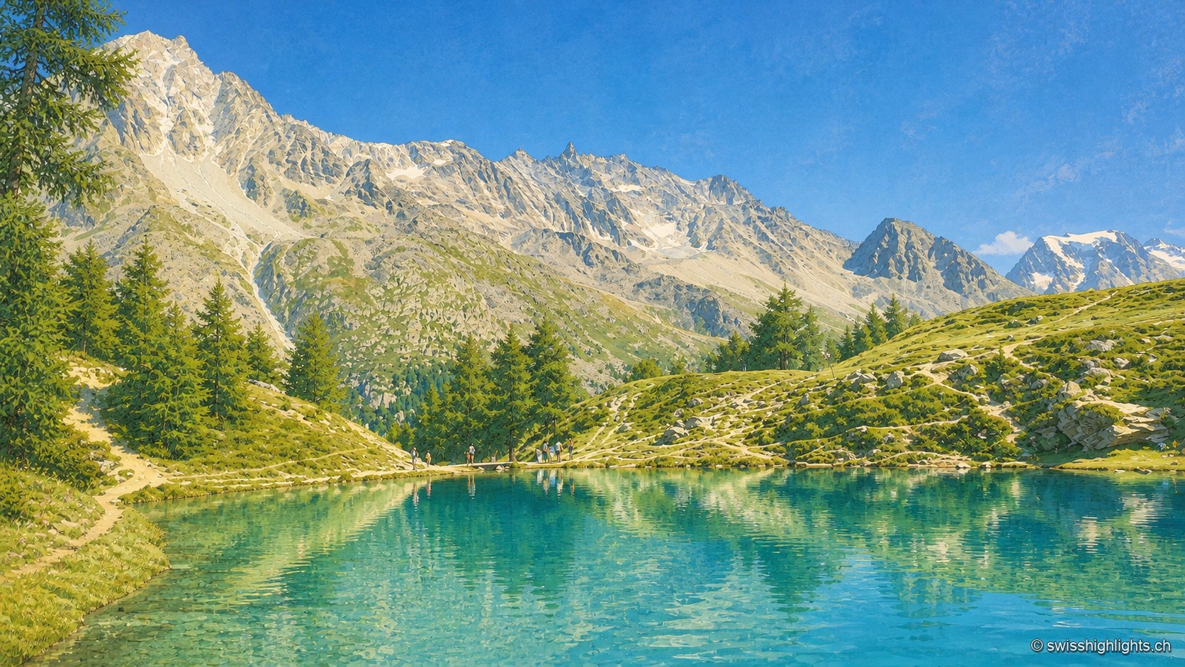
A mountain lake with turquoise, transparent, still waters, reflecting a jagged rock face streaked with snowfields under a clear blue sky. On the near shore, a few larch trees and a dirt path run alongside the water; small silhouettes of hikers stand at the edge, giving scale to the landscape.

Mountain lake · Valais

Lac Bleu d'Arolla

Ringed by larches and Swiss stone pines at the place called Le Louché, the lake is fed by an inflow rising 10 metres upstream; its outflow reaches the Borgne d'Arolla via the Aiguilles Rouges torrent, after about 280 metres.
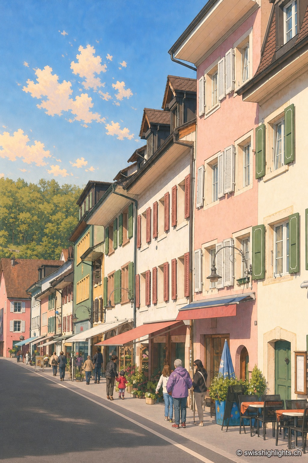
Asphalt-paved street of the town of Laufen in vertical perspective, lined with pastel-toned façades — pink, almond green, ochre — with shutters and signs; a few passers-by and café tables enliven the sidewalk under a blue sky with scattered clouds.

Town on the Birs · Basel-Landschaft

Laufen

After refusing in 1974 to join the canton of Jura, Laufen opted in 1994 for Basel-Landschaft; its main street, closed by two gates, is lined by the church of Sainte-Catherine, built from 1698.
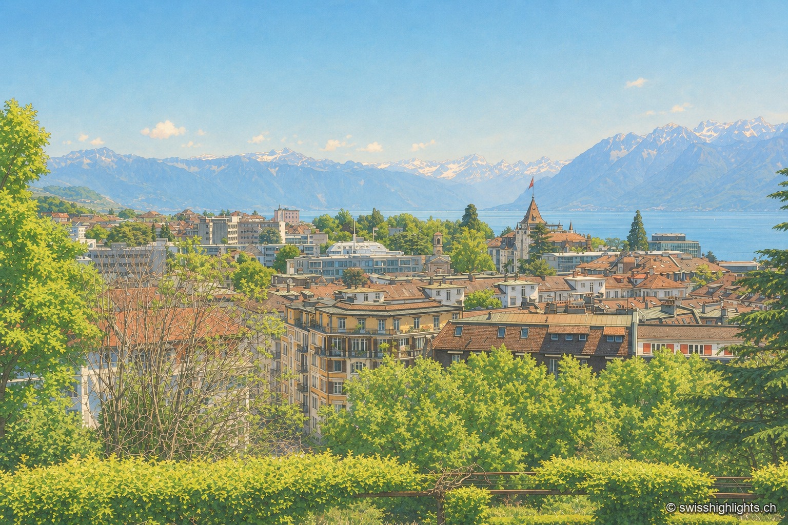
Overlooking view of Lausanne from the crêt de Montriond: the city's tiled roofs cascade downhill toward Lake Geneva, its shoreline glittering in the distance before the Alps, under a clear sky.

City on a slope · Lake Geneva

Lausanne

Built on three hills above Lake Geneva, Lausanne climbs without pause. Its cathedral, raised between 1170 and 1230, is the most important Gothic one in Switzerland, and the International Olympic Committee has sat here since 1915.
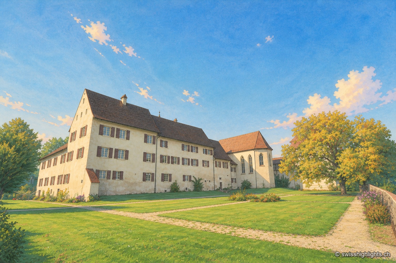
Slightly elevated view of the fortified Löwenburg estate: a long whitewashed building with a brown tiled roof, pierced by rows of shuttered windows, extends toward a chapel with buttresses and a corner turret; a lawn crossed by a gravel path draws the eye toward the ensemble, under a clear blue sky, with a few trees on the right of the frame.

Hamlet and ruin · Jura

Löwenburg

The hamlet of Löwenburg, the only German-speaking part of the commune of Pleigne, combines a castle ruin founded in the 10th century with a 16th-century fortified farm; the Christoph Merian Foundation of Basel has restored it since 1956.
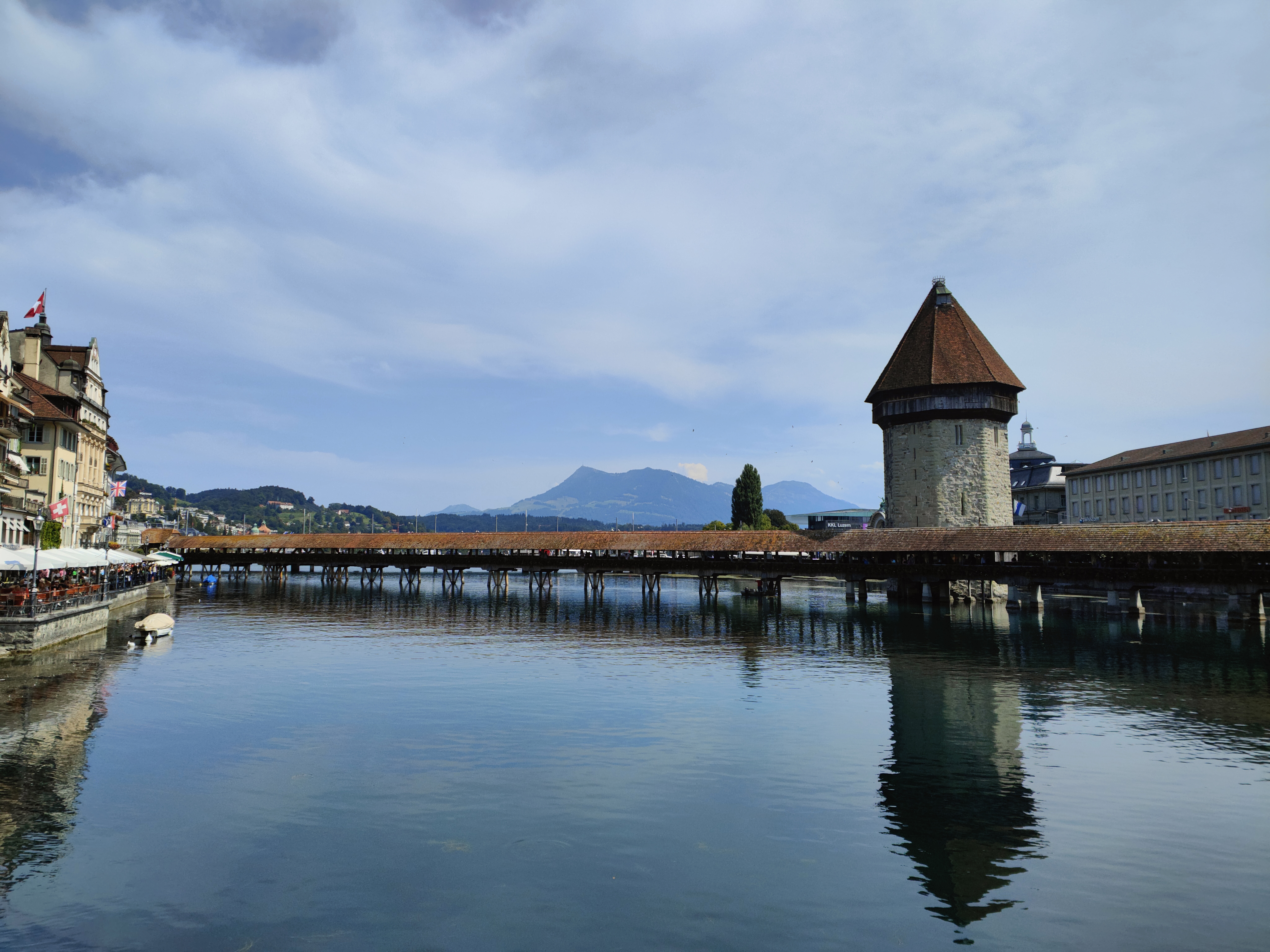
The Chapel Bridge and its octagonal water tower span the Reuss at dusk; the lights of Lucerne's old town, with its snow-covered roofs, reflect in the calm water under a blue winter sky.

Old town and covered bridge · Lucerne

Lucerne, old town and Kapellbrücke

It joined the Confederation in 1332, before any other town; along the Reuss, Lucerne lines up a wooden bridge of 1333, an octagonal water tower older than the bridge, and 870 metres of curtain wall with nine towers.
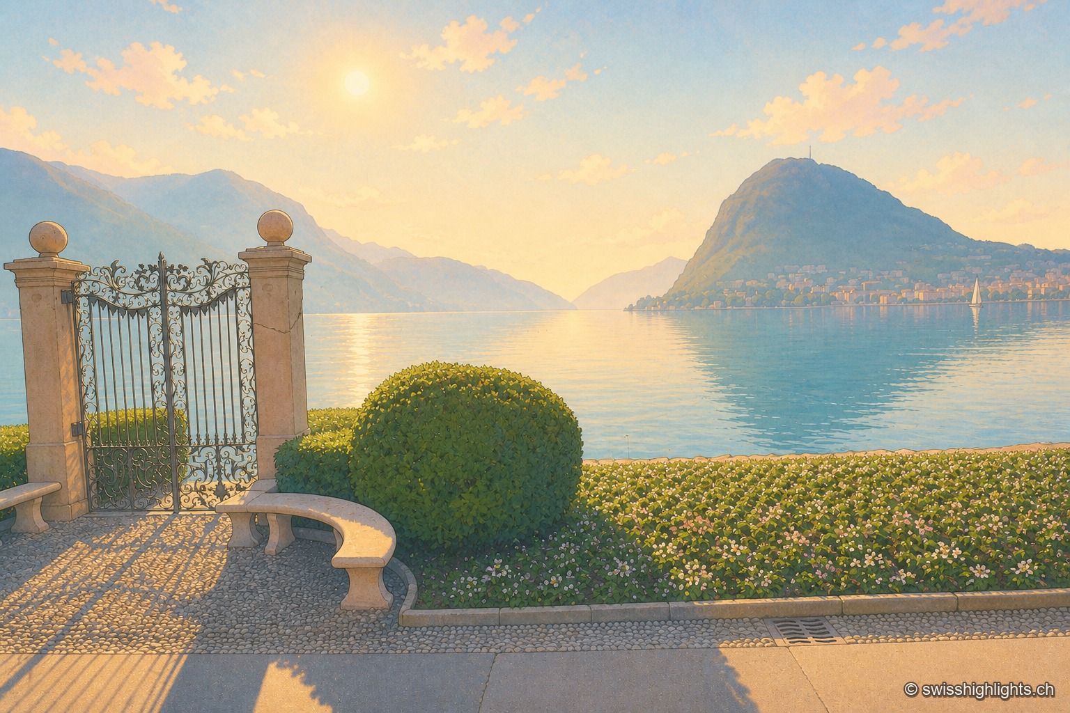
Wrought-iron gate open onto the shore of Lake Lugano, shot against the light, the low sun blazing between the two stone pillars; in the distance, the bluish silhouette of Monte San Salvatore dominates the town and the calm lake water reflecting the light.

Lakeside city · Ticino

Lugano

The country's third financial centre, Lugano hosted the first Eurovision Song Contest in 1956 and has, since the mergers of 2004, 2008 and 2013, an agglomeration of about 150,000 inhabitants on the shore of Lake Lugano.
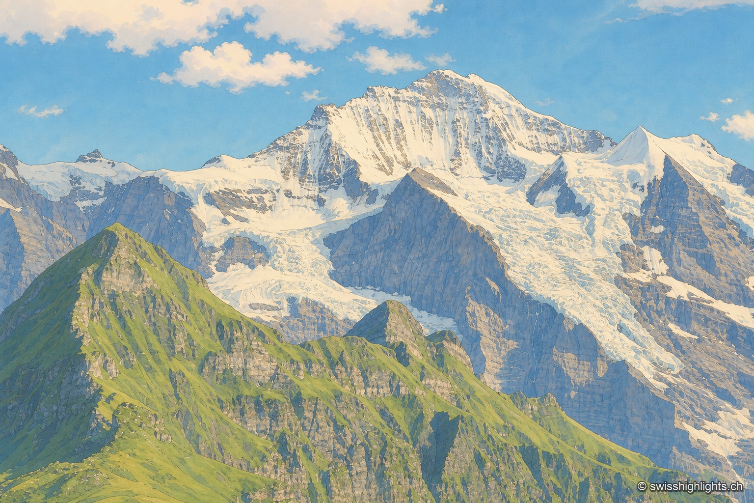
The Jungfrau massif seen from a neighboring peak: in the foreground, a green grassy ridge stands out against the rocky and glaciated wall, streaked with snowfields and hanging glaciers descending from the ridges; to the right, a darker rocky peak is outlined against a blue sky dotted with large white clouds.

Summit · Bernese Alps

Jungfrau

The mountain overlooks Lauterbrunnen, Grindelwald and Lake Thun. Since 1912 a rack railway has climbed to the Jungfraujoch, above 3,400 metres. The Jungfrau-Aletsch site has been a World Heritage property since 2001.
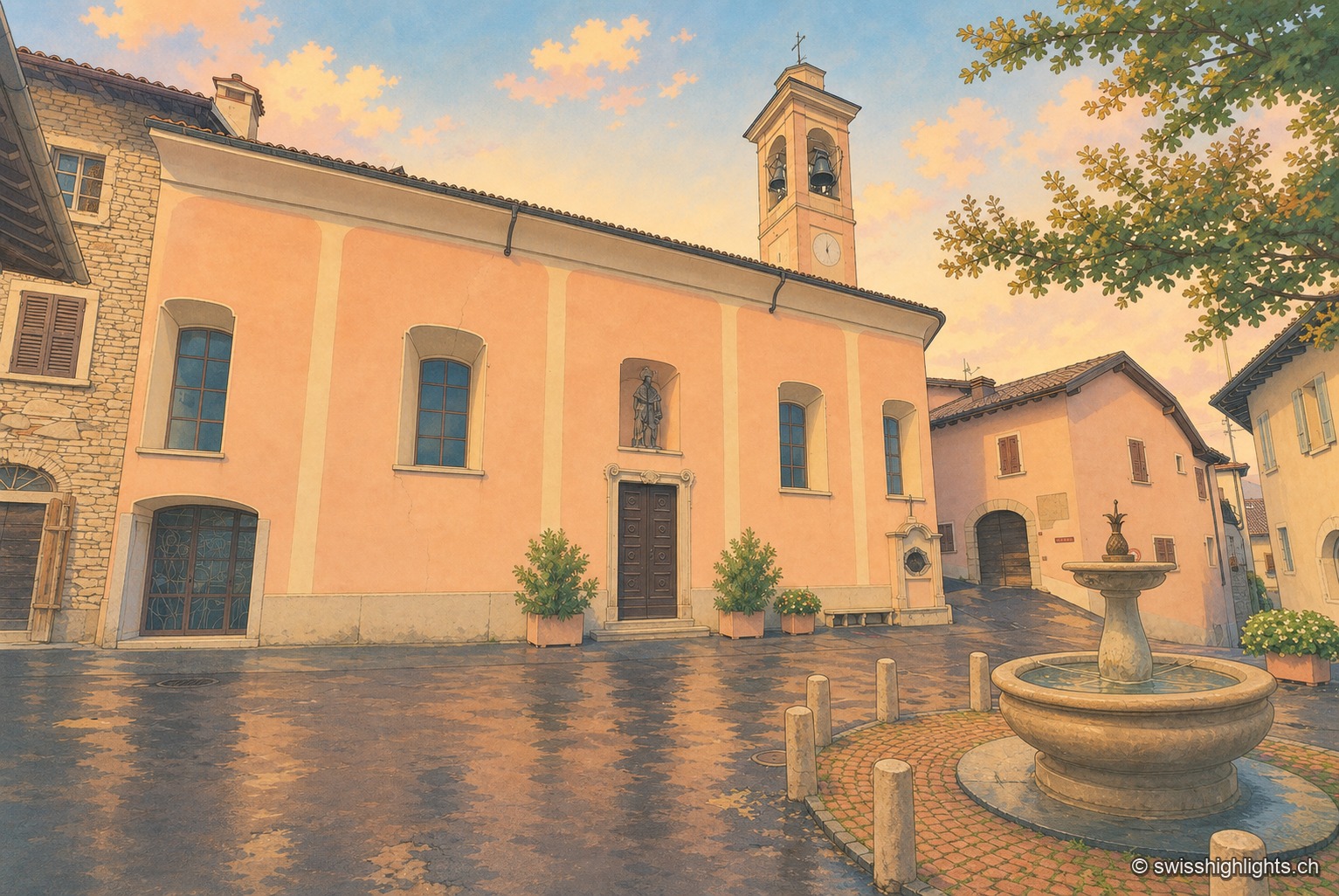
The ochre façade of the village church of Meride, flanked by its bell tower with an onion-domed steeple and a statue in a niche above the portal; on the wet paved square reflecting an end-of-day sky, a stone fountain and flower pots stand before the entrance, a tree on the right.

Village · Ticino

Meride

Recorded as early as 852, Meride long lived off the departure of its stucco workers and painters for northern Europe. Its land runs up to the summit of Monte San Giorgio, World Heritage listed in 2003 for its fossils.
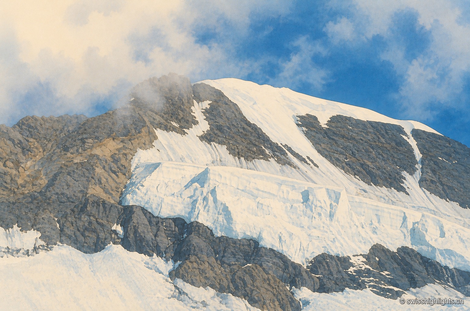
Close-up of the summit ridge of the Mönch: snow and crevassed ice cover the rock face, a plume of cloud brushes the ridge under a blue sky.

Bernese Alps summit · 4,110 m

Mönch

Middle link of the Eiger–Mönch–Jungfrau chain, it reaches 4,110 metres. Its south face rests on the Jungfraufirn, a tongue of the Aletsch glacier; its name is thought to come from a horse pasture, not from a monk.
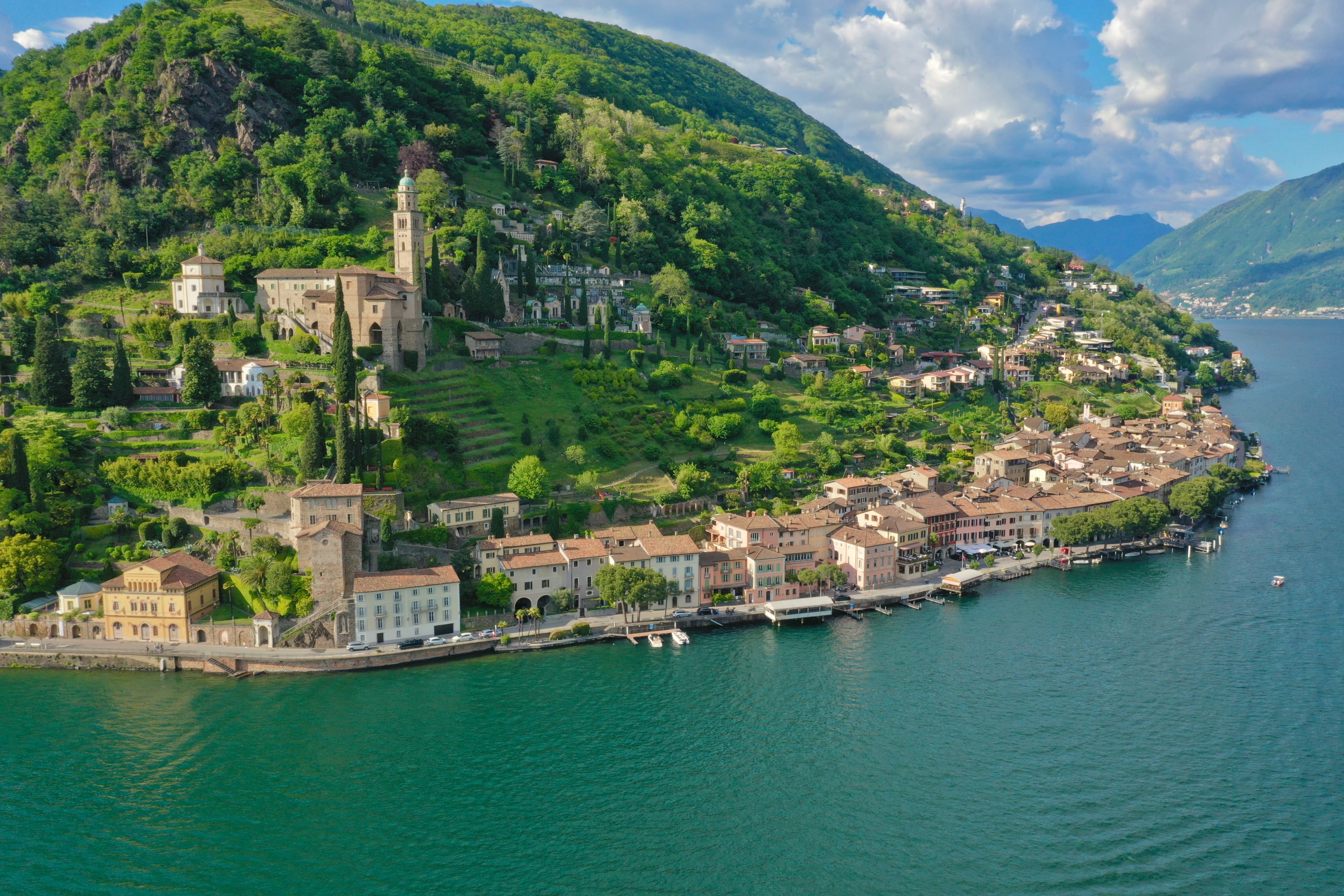
An aerial view of Morcote: the houses lined up along the shore of Lake Lugano, the church of Santa Maria del Sasso and its bell tower on the wooded slope above the village.

Ticino · Lake Lugano

Morcote

Morcote is strung along the shore of Lake Lugano, facing Italy. Above the roofs stands the church of Santa Maria del Sasso; between them, a stairway of 404 steps and a cemetery of 1750.
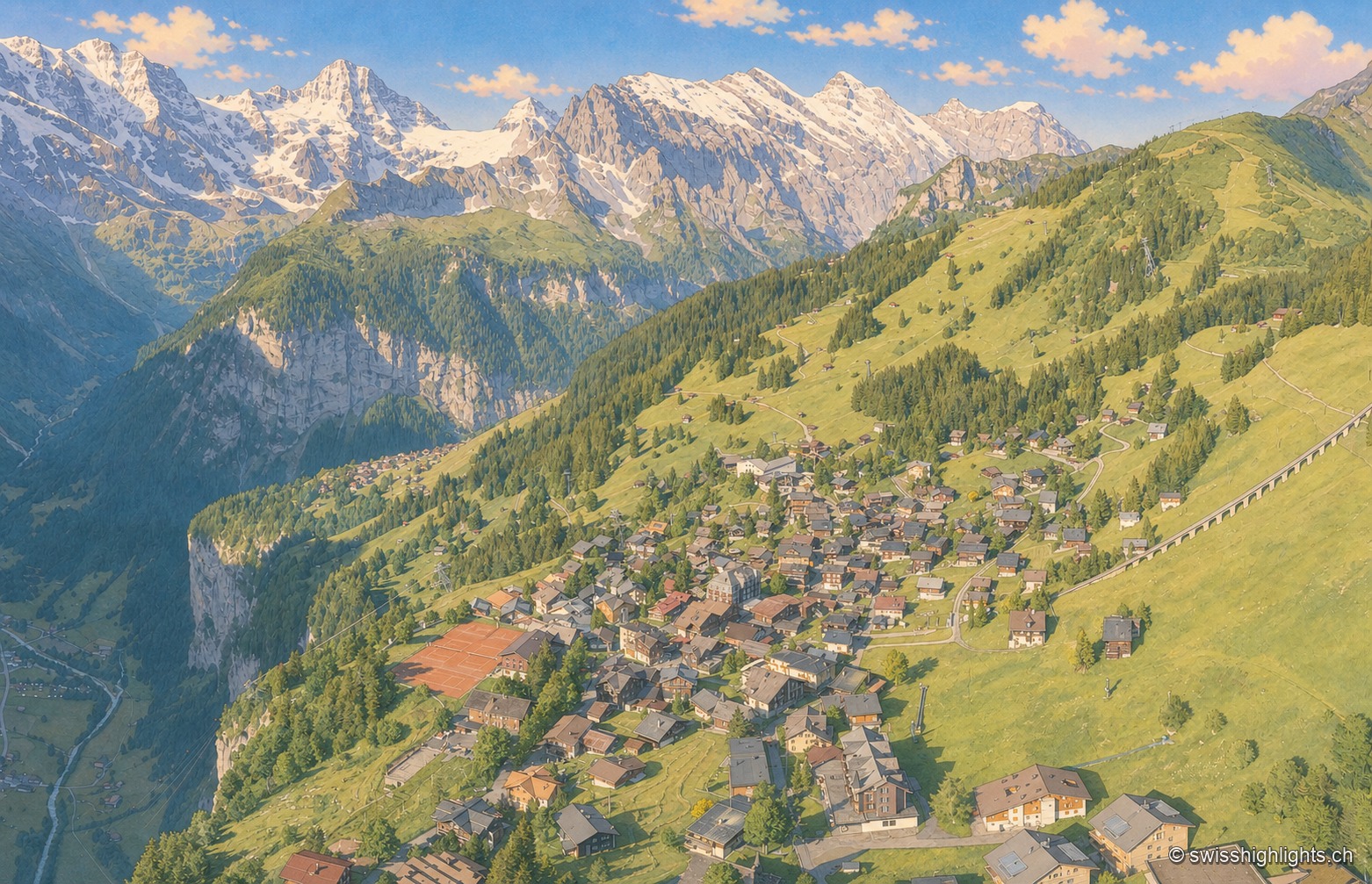
An aerial view of the village of Mürren, its chalets scattered across a wide grassy terrace overlooking the deep, wooded Lauterbrunnen valley, facing a range of snow-capped peaks under a sky streaked with golden clouds.

Car-free village · Bernese Alps

Mürren

Overlooked by the Schilthorn (2,970 m), Mürren was one of the Alps' earliest homes of alpine skiing: the Downhill Only Club forged the discipline there, and Arnold Lunn invented the slalom in 1922. Reachable only by cable car and train.
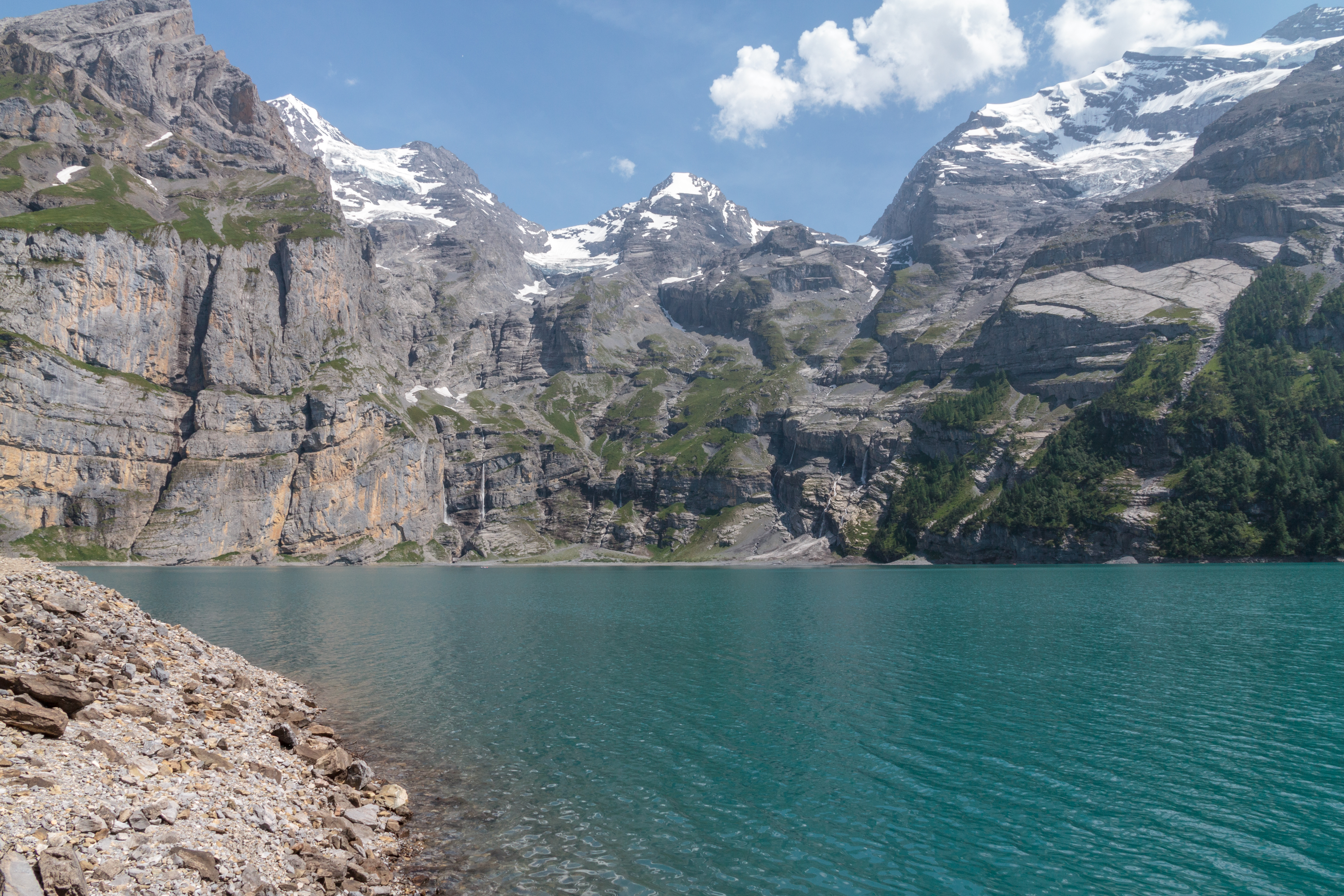
The turquoise waters of Lake Oeschinen hemmed in by high limestone walls streaked with snow patches, seen from a fir-wooded promontory, under a changeable sky.

High-altitude lake · Bernese Oberland

Oeschinensee

A lake of 1.1 square kilometres held at 1578 metres by rock masses fallen from the Fründenhorn and the Doldenhorn, with no surface outflow, at the western edge of the UNESCO property Swiss Alps Jungfrau-Aletsch.
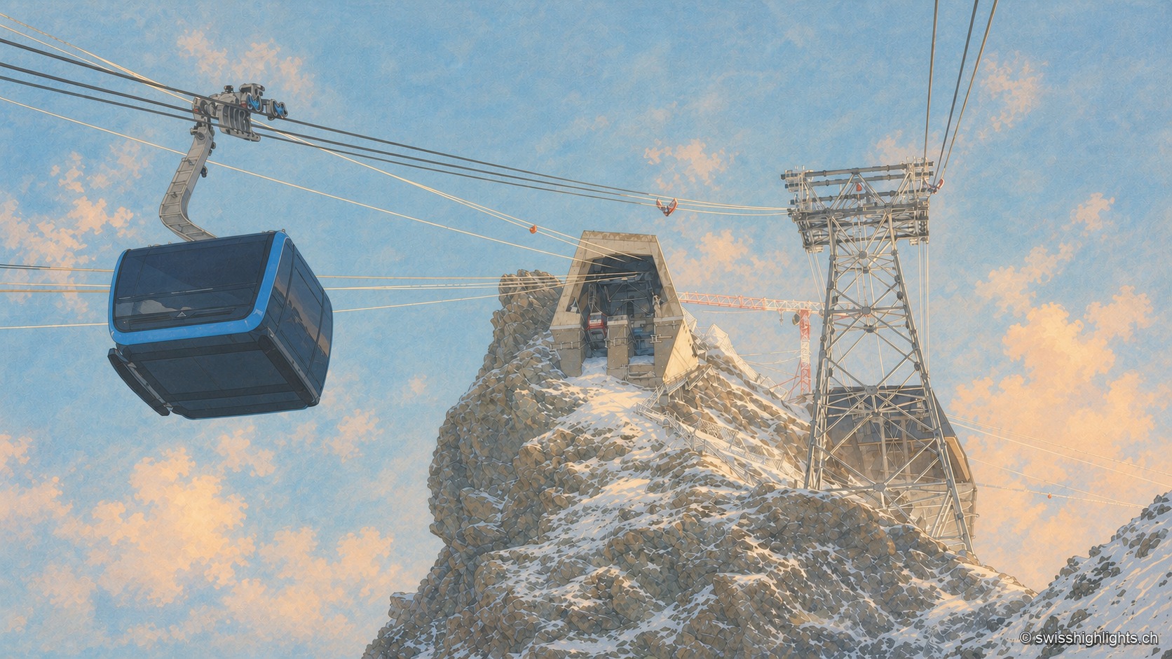
Under a deep blue winter sky, a dark cable-car cabin glides through the left half of the frame, suspended from its cables; at the center, the concrete summit station is set into the snow-covered rocky ridge of the Klein Matterhorn, and a steel pylon stands to the right, amid snow whipped up by the wind.

Summit · Valais

Klein Matterhorn

Surveys give it as 3,882 or 3,883 metres, a little over a kilometre from the Italian border. Its north face carries a cable-car station at 3,820 metres, from which a 160-metre tunnel runs through the mountain.
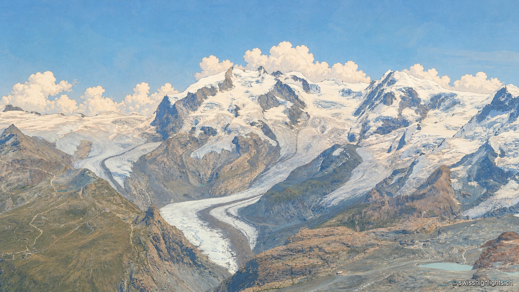
An aerial view of the Gorner Glacier, a broad, crevassed white tongue winding between dark rock walls, with the fully snow-covered Monte Rosa massif ringed by clouds in the background, under a clear blue sky.

Switzerland's highest summit · Valais

Dufourspitze

Named in 1863 for Guillaume Henri Dufour, first climbed on 1 August 1855 by a British party guided by two men from Zermatt, it is Europe's ninth-highest summit, 130 m from the highest point of the Italian-Swiss border.
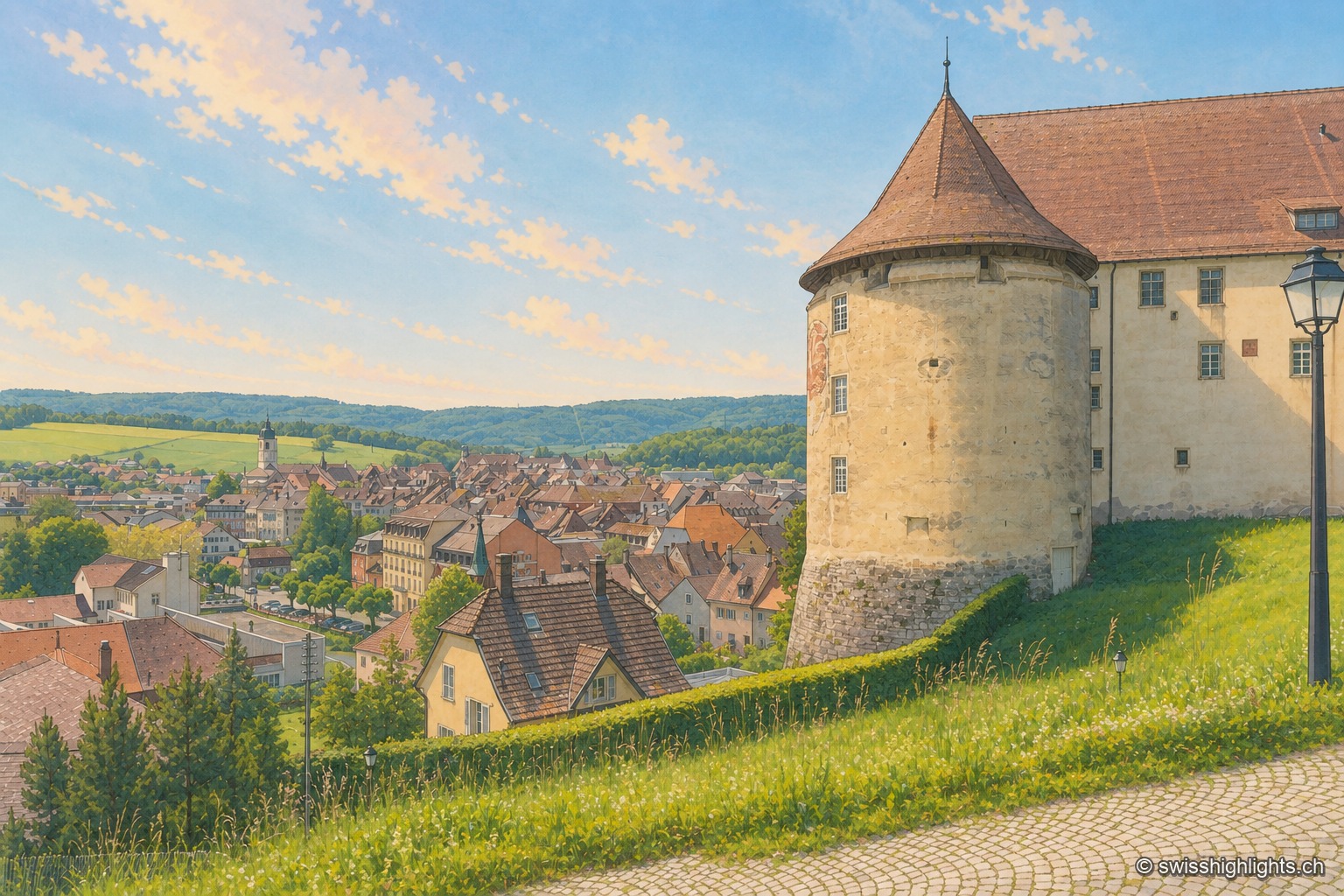
From the castle terrace, the large round tower with a conical roof occupies the right of the frame, against the long whitewashed building; below spread the brown and red roofs of the old town of Porrentruy, the light-colored church steeple, and behind them the wooded hills of the Jura under a pale blue summer sky.

Town · Ajoie, canton of Jura

Porrentruy

Driven from Basel by the Reformation, the prince-bishops settled in Porrentruy after 1528; their supposedly provisional residence lasted until 1828. Castle, Jesuit college, hôtel-Dieu and stone fountains still hold its measure.
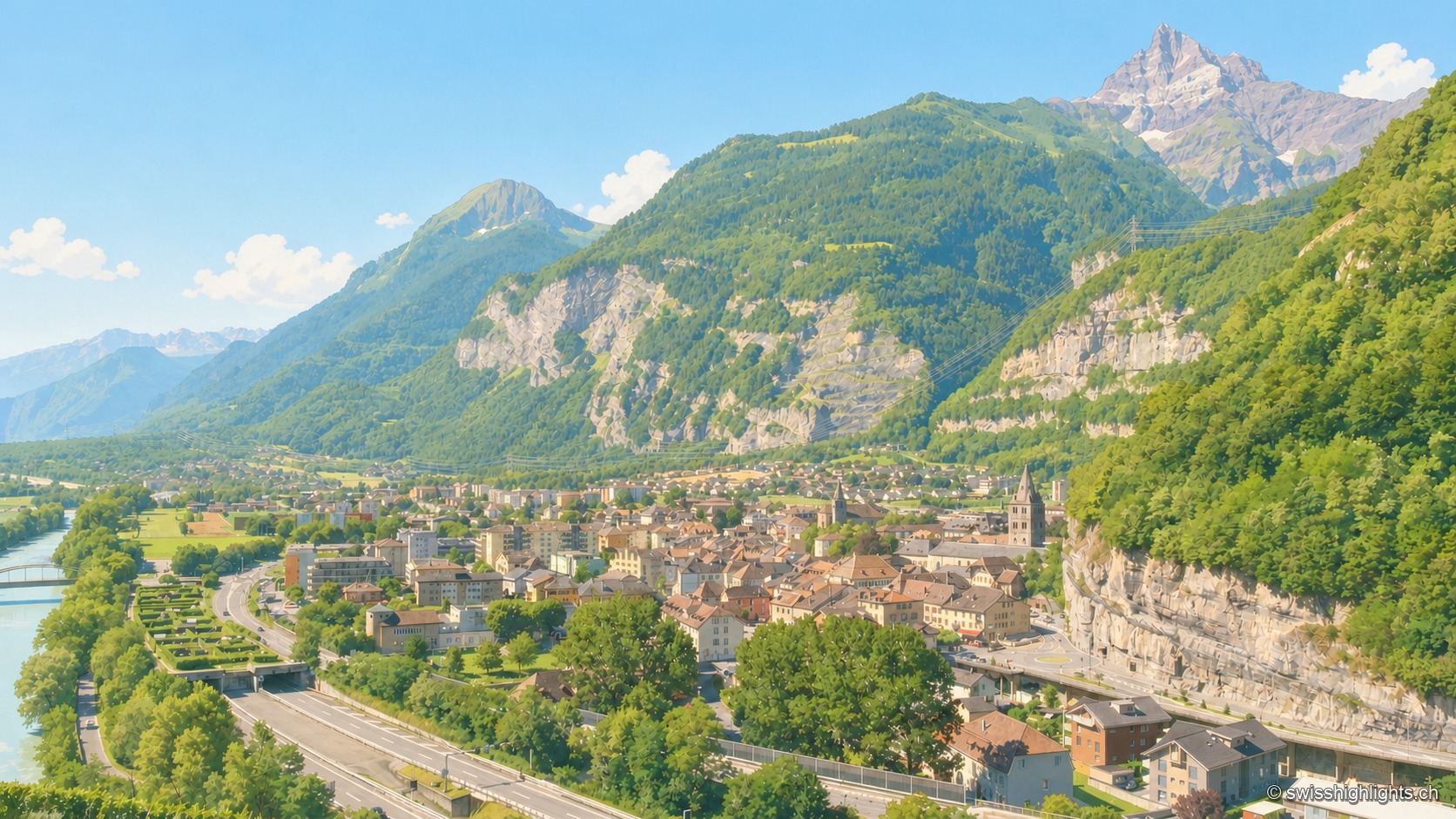
Elevated summer view of Saint-Maurice, taken from a high point to the south: the town occupies the narrow plain between the emerald-green Rhône, bordered by grassy embankments on the left, and a steep limestone cliff on the right, pierced by a road tunnel; at the center, the bell towers of the abbey and the town stand out among the roofs; in the distance, under a clear blue sky, a sharp rocky peak — the Dents du Midi — dominates the valley.

Lock on the Rhône · Valais

Saint-Maurice

A stage on the Via Francigena recorded as early as 990, locked by the Château des Gouverneurs and its 12th-century bridge over the Rhône, the town burned down in 1693 before planting, first in Valais, a liberty tree in 1798.
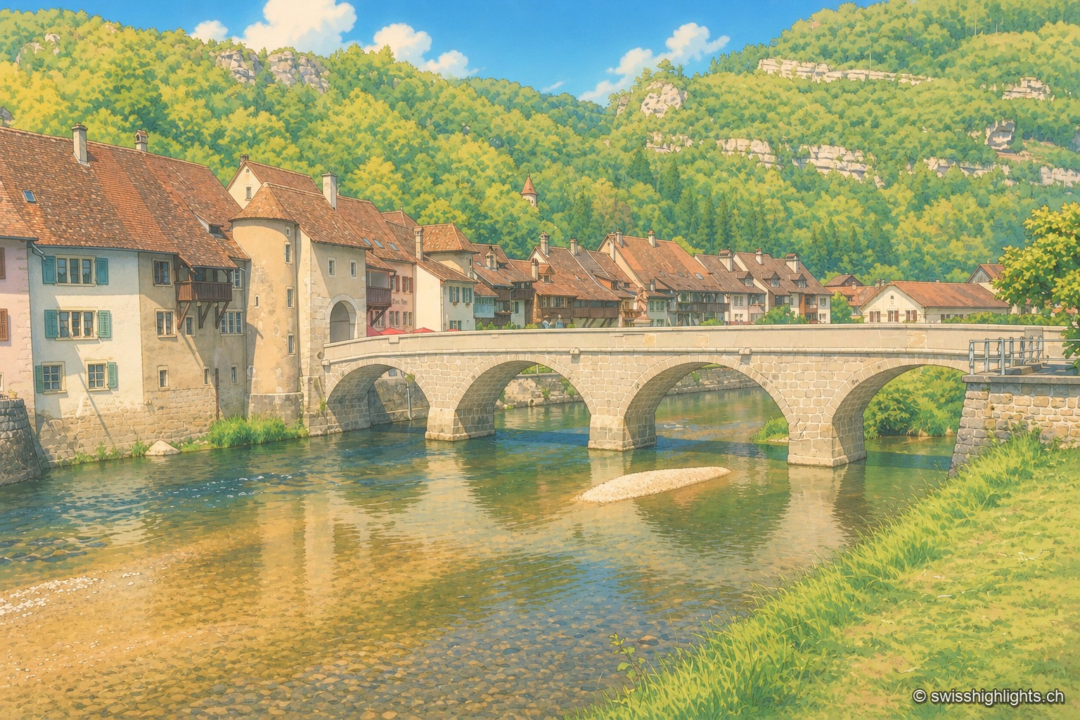
The medieval multi-arched bridge of Saint-Ursanne spans the green waters of the Doubs, in front of the tiled-roof houses and tower of the old town, set against a wooded hillside of the Jura.

Medieval small town · Jura

Saint-Ursanne

Born around a Benedictine abbey, it keeps its Romanesque collegiate church, its cloister and burgher houses from the 14th to the 16th century. At 440 metres, between wooded cliffs and river, it left its isolation only in 1877.
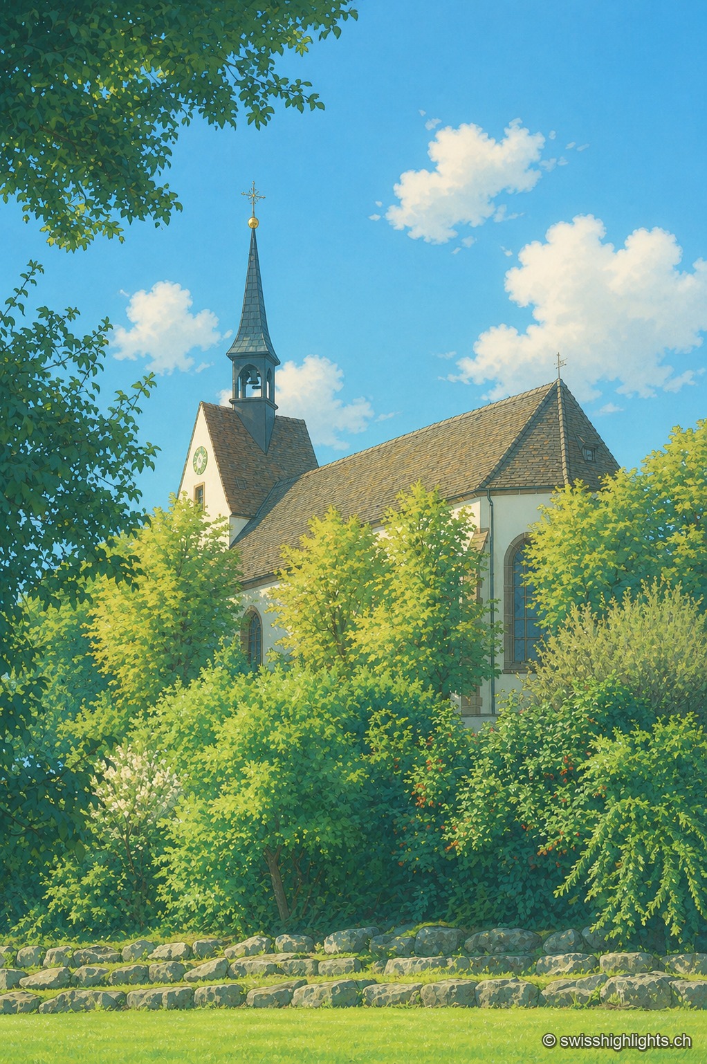
The Sankt Chrischona church seen through the foliage: its slender spire topped with a cross and its tile-roofed nave rise from a setting of lush green trees, under a blue sky dotted with clouds.

Religious site · Basel-Stadt

Sankt Chrischona

On the Dinkelberg, at 522 metres, the highest church in canton Basel-Stadt stands over a walled cemetery and mission buildings founded in 1840; its tower platform, up 71 steps, opens a panorama over the Vosges, the Black Forest, the Jura and the Alps.
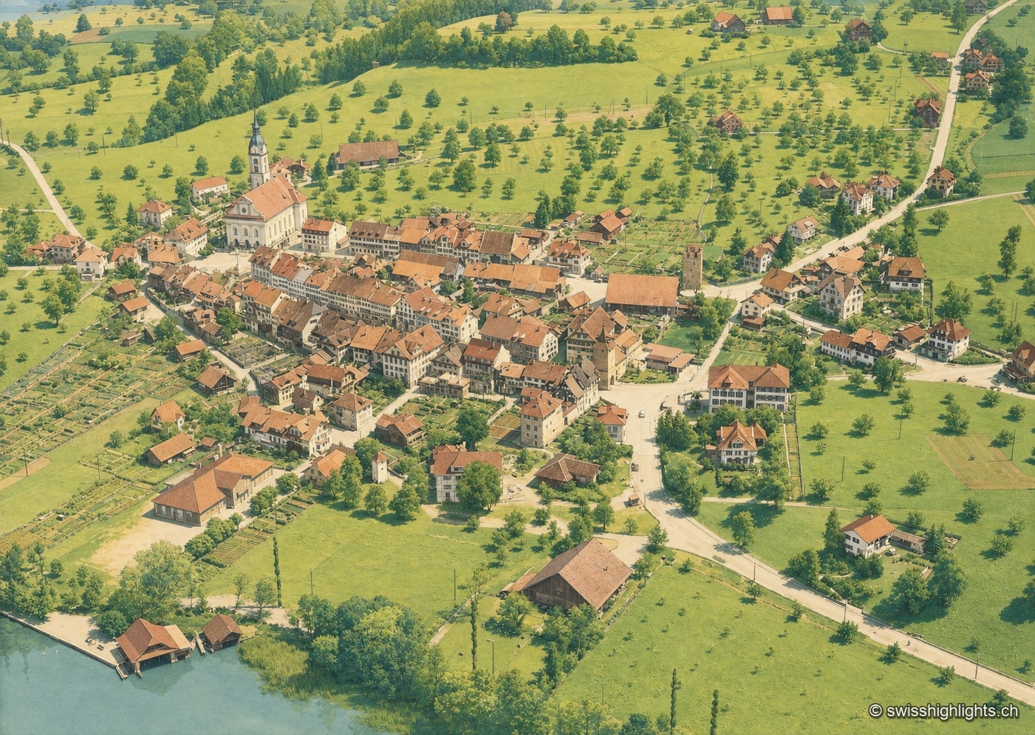
Colorized historical aerial view of Sempach, a lakeside village surrounded by orchards and fields, on the shore of Lake Sempach.

Battle town · Lucerne

Sempach

On 9 July 1386, the Battle of Sempach saw the Lucerners and their allies defeat the Habsburgs; the Sempach Pact was signed there in 1393. The town received the Wakker Prize in 2017 for preserving its old town.
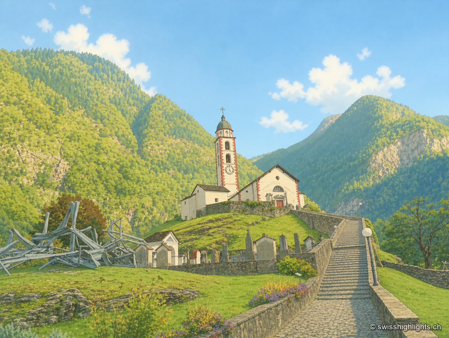
The church of Soazza overlooks the village from its grassy spur, at the top of a stone staircase; in the foreground, a structure of metal beams stands in the grass, between wooded slopes and a clear sky.

Mesolcina village · Grisons

Soazza

324 inhabitants on 46.4 km², more than half of it forest, a church with a striped bell tower on its spur, a frescoed hospice: Soazza holds the hinge between upper and lower Mesolcina.
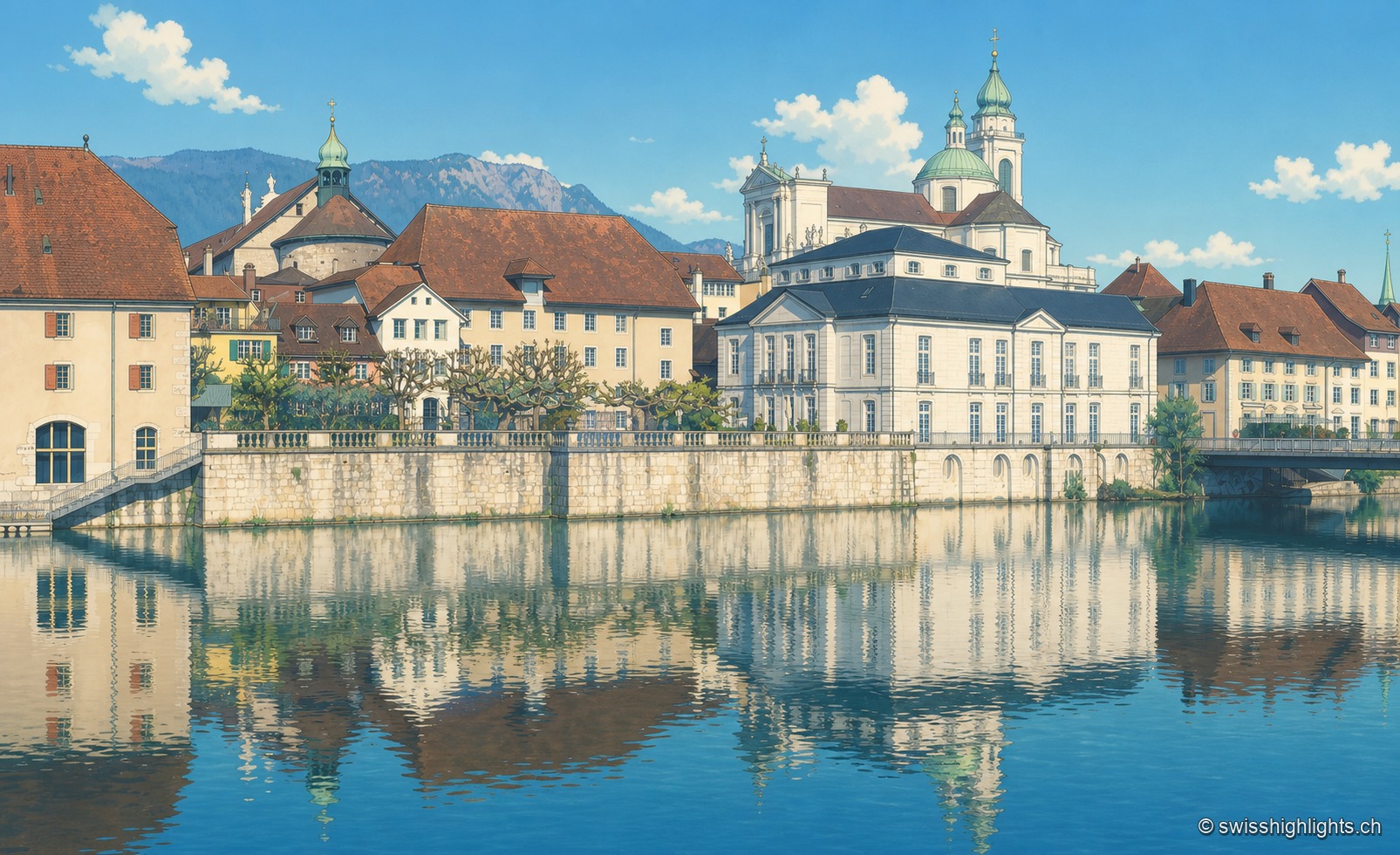
The old town of Solothurn is reflected in the Aare, dominated by the pale towers of St. Ursus Cathedral, under a clear blue sky.

City of ambassadors

Solothurn

Founded by Rome as Salodurum, admitted to the Confederation in 1481, Solothurn keeps towers and gates from the 15th-16th centuries around its baroque cathedral and its town hall, completed in 1711. 16,847 inhabitants at the end of 2024.
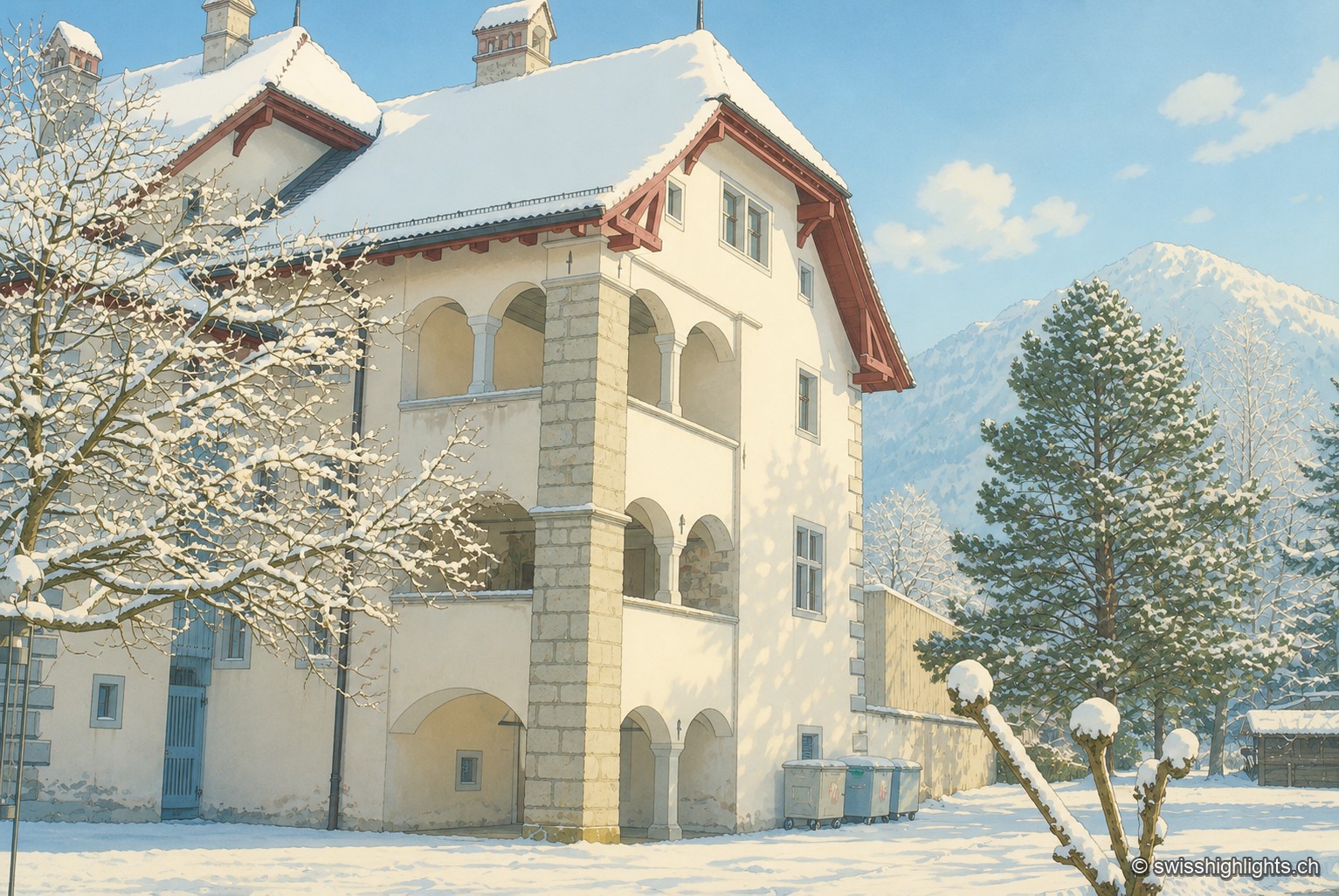
The Winkelriedhaus in Stans under snow: a pale plastered façade with three levels of arcaded loggias and a red tile roof, surrounded by snow-laden trees, with a snow-covered summit in the background under a blue sky.

Below the Stanserhorn · Nidwalden

Stans

In September 1798, French troops killed 414 residents there, including about a hundred women and twenty-six children, in response to the canton's resistance. Today Stans also lives on aviation, with the Pilatus Aircraft plant.
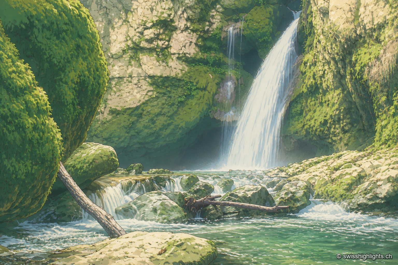
The Tine de Conflens waterfall pours down between moss-covered walls, in the hollow of a deep-cut cirque where the white water stands out sharply against the rock and dark vegetation.

Rock cirque · Vaud Jura

Tine de Conflens

Named after a Vaud patois phrase meaning 'confluence falls', the Tine de Conflens brings together two waterfalls: the Veyron's and the Venoge's, which it swells. A steep but maintained path leads to their foot.
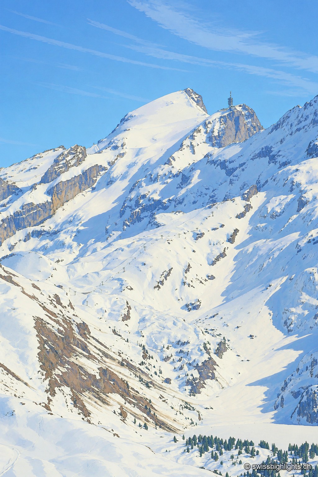
The snow-covered summit of the Titlis rises as a white point against a blue sky, extended to the right by a rocky spur crowned with an antenna tower; below, snowfields and rock walls overlook a wide basin of snow crossed by a ski lift.

Summit · Obwalden–Bern

Titlis

The Titlis reaches 3,238 metres at the end of an east–west limestone ridge. A glacier of 1.7 square kilometres covers its summit area; the upper cable-car station stands at 3,020 metres.
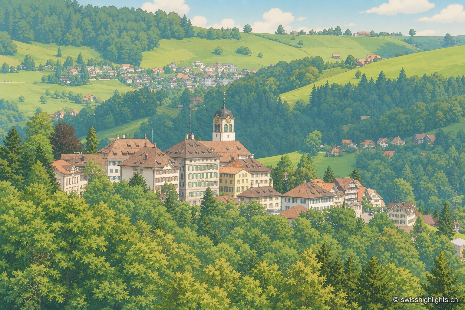
The village of Trogen, dominated by its church bell tower and a large white building with a pentagonal floor plan, stretches along a wooded hillside surrounded by rolling green hills.

Village · Appenzell Ausserrhoden

Trogen

Trogen became the capital of Appenzell Ausserrhoden in 1597 and lines its square with the Zellweger family's palaces, built between 1747 and 1809 from the textile trade. The Landsgemeinde met here until it was abolished in 1997.
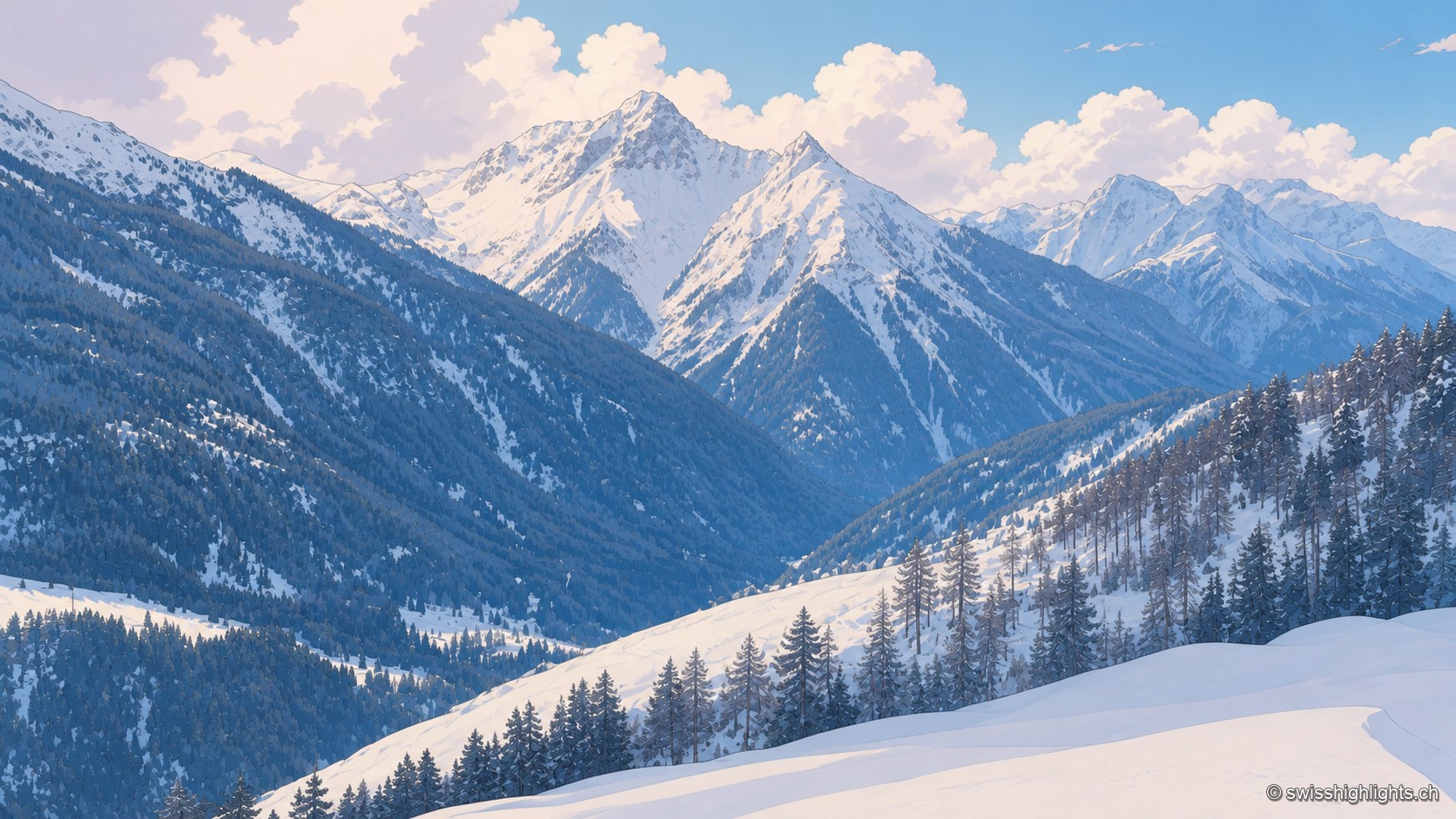
Winter view of an alpine valley near Tschlin: snow-capped peaks rise above forested slopes, with snow-covered fir trees in the foreground under a sky dotted with clouds.

Romansh village · Grisons

Tschlin

The village holds a terrace at 1,553 metres, far above the Inn. Vallader Romansh is spoken here, and the three-country marker at 2,180 metres is visible to the naked eye. A former commune, Tschlin joined Valsot in 2013.
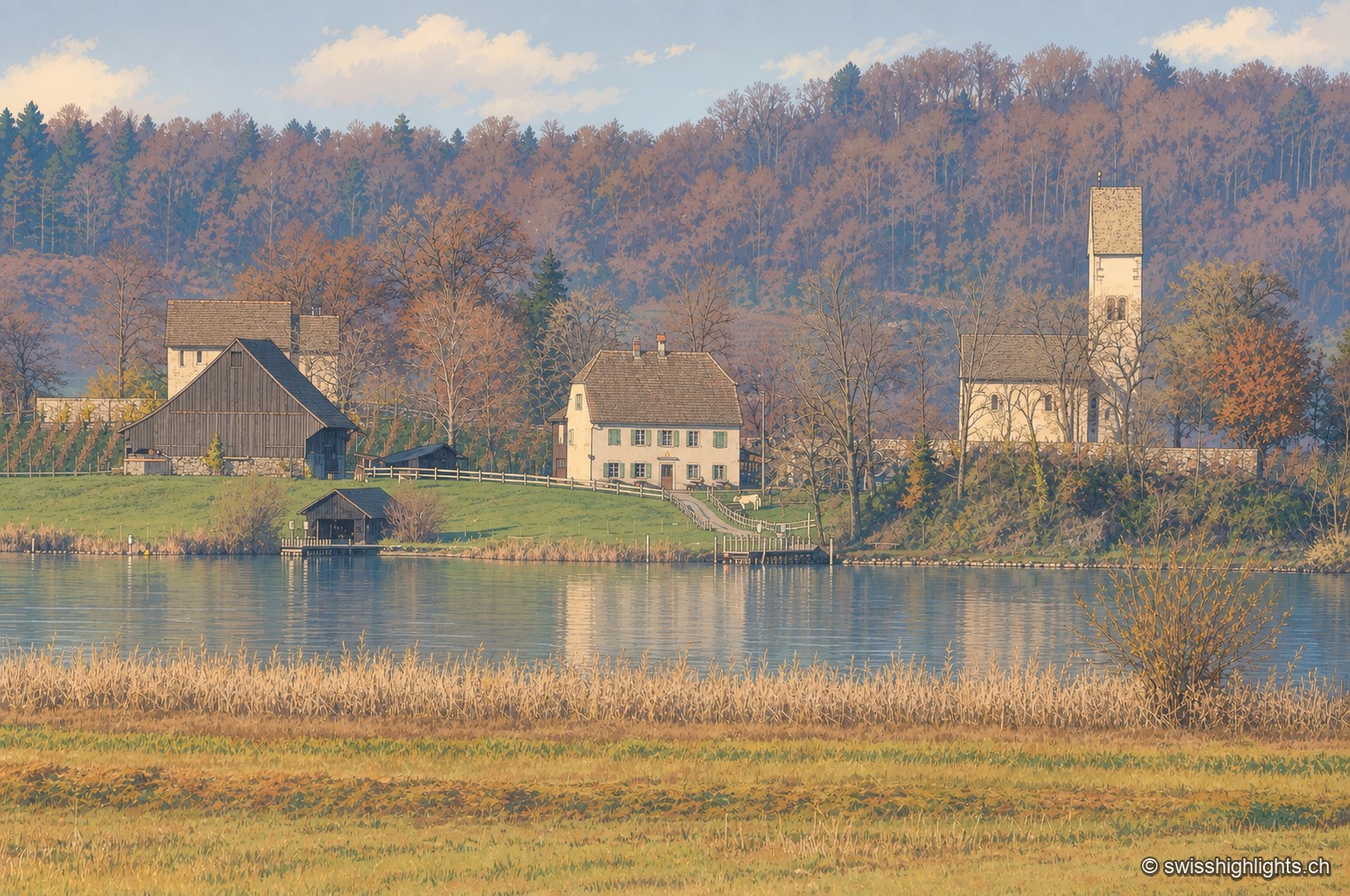
On the shore of Lake Zurich, a dark half-timbered barn and a white manor house stand next to the Romanesque tower-porch of Ufenau church, surrounded by trees in autumn colors and reeds in the foreground.

Monastic island · Lake Zurich

Ufenau

Otto I gave the island to Einsiedeln Abbey in 965. The church of Saints Peter and Paul was consecrated in 1141. Knight Ulrich von Hutten died here in 1523. In 2012, the site's protected status blocked a restaurant by Peter Zumthor.
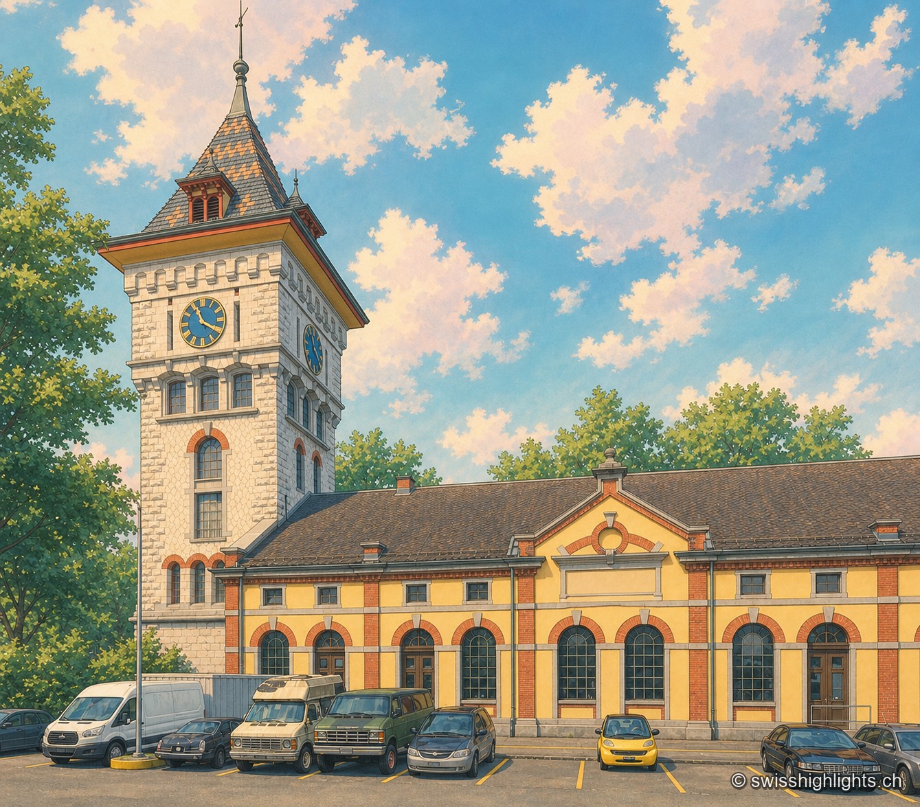
The clock tower of the former Gaswerk Schlieren power station, built of pale stone with a conical roof of orange and grey diamond tiles and two visible clock faces, rises above the yellow-and-brick hall of the neighbouring Kraftcentrale; the sky is blue, dotted with large white clouds, and a few cars are parked in front of the building.

Former gasworks · Zurich

Schlieren Gasworks

Opened in 1898 and expanded through 1909, the Schlieren gasworks produced up to 250,000 m³ of gas a day before closing in 1974. Its gasometer now houses a museum and a working steam engine.
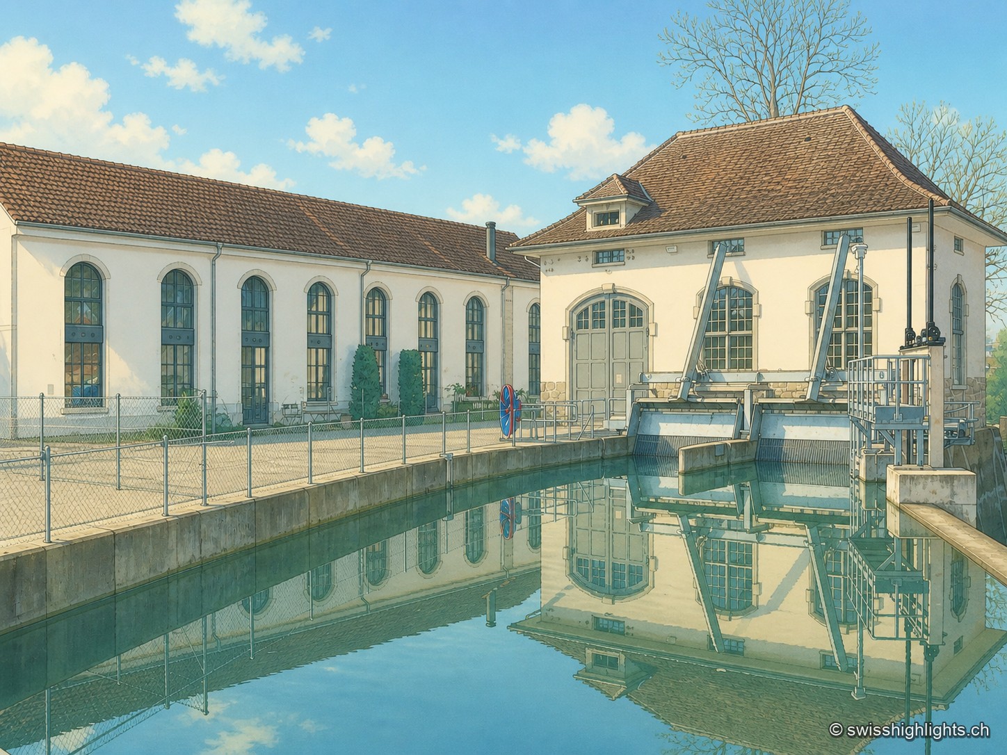
The industrial building of Lorzenweid, with its white façade of arcaded windows and hipped roof topped by a small bell turret, is reflected together with the neighbouring turbine house in the calm waters of the canal, under a blue sky with white clouds.

Former mill on the Lorze, ISOS site

Lorzenweid industrial site

The complex sits on the Lorze, whose hydraulic power once drove the mill's turbines; the weir of the Hagendorn power station survives on the river, alongside a road bridge and a wooden bridge.